MyTopo
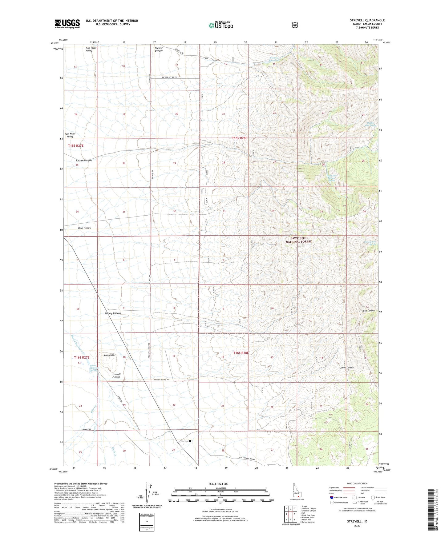
Strevell Idaho US Topo Map
Couldn't load pickup availability
Also explore the Strevell Forest Service Topo of this same quad for updated USFS data
2023 topographic map quadrangle Strevell in the state of Idaho. Scale: 1:24000. Based on the newly updated USGS 7.5' US Topo map series, this map is in the following counties: Cassia. The map contains contour data, water features, and other items you are used to seeing on USGS maps, but also has updated roads and other features. This is the next generation of topographic maps. Printed on high-quality waterproof paper with UV fade-resistant inks.
Quads adjacent to this one:
West: Naf
Northwest: Bridge
North: Sandrock Canyon
Northeast: Sweetzer Canyon
East: Black Pine Peak
Southeast: Curlew Junction
South: Kelton Pass
Southwest: Rosevere Point
This map covers the same area as the classic USGS quad with code o42113a2.
Contains the following named places: Birch Creek, Deer Hollow, Gunnell Guard Station, Gunnell Post Office, Hidden Rock Spring, Kelsaw Canyon, Moberg Canyon, Porter Creek, Rice Canyon Spring, Rice Creek, Round Mountain, Round Mountain Spring, Sixmile Canyon, Six-Mile Ranch, Sixmile Reservoir, South Fork Kelsaw Spring, Strevell, Strevell Canyon