MyTopo
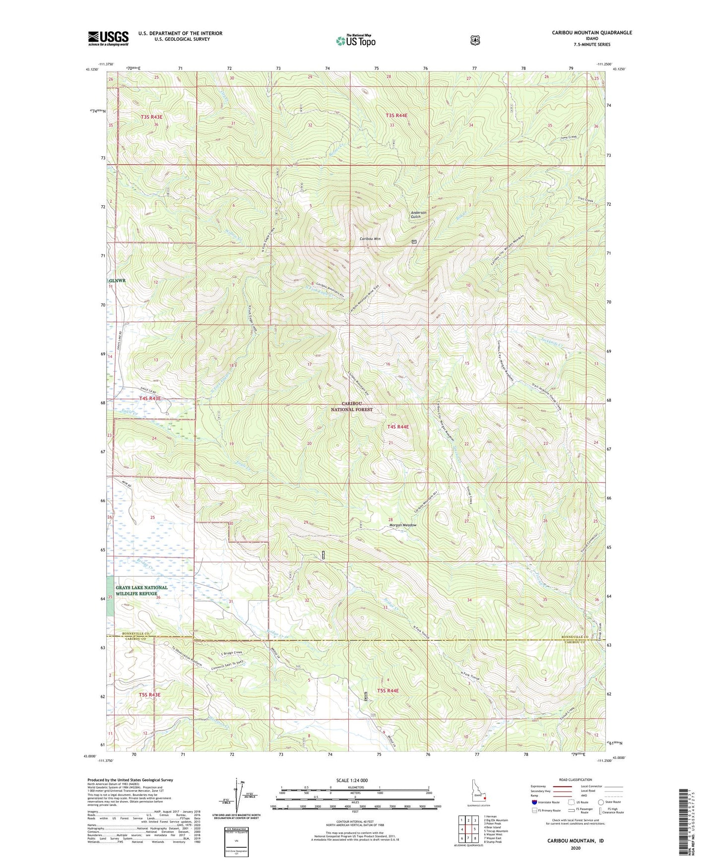
Caribou Mountain Idaho US Topo Map
Couldn't load pickup availability
Also explore the Caribou Mountain Forest Service Topo of this same quad for updated USFS data
2023 topographic map quadrangle Caribou Mountain in the state of Idaho. Scale: 1:24000. Based on the newly updated USGS 7.5' US Topo map series, this map is in the following counties: Bonneville, Caribou. The map contains contour data, water features, and other items you are used to seeing on USGS maps, but also has updated roads and other features. This is the next generation of topographic maps. Printed on high-quality waterproof paper with UV fade-resistant inks.
Quads adjacent to this one:
West: Bear Island
Northwest: Herman
North: Big Elk Mountain
Northeast: Poker Peak
East: Tincup Mountain
Southeast: Stump Peak
South: Wayan East
Southwest: Wayan West
This map covers the same area as the classic USGS quad with code o43111a3.
Contains the following named places: Caribou City, Caribou Mountain, Caribou Range, Evergreen Mine, Monte Cristo Mine, Morgan Meadow, North Fork Eagle Creek, ZIP Code: 83285