MyTopo
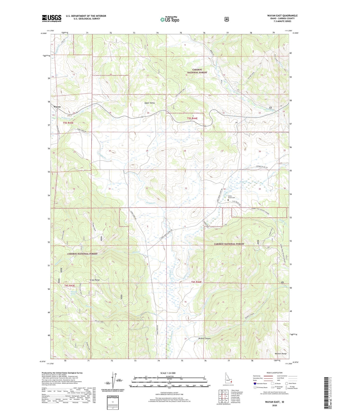
Wayan East Idaho US Topo Map
Couldn't load pickup availability
Also explore the Wayan East Forest Service Topo of this same quad for updated USFS data
2023 topographic map quadrangle Wayan East in the state of Idaho. Scale: 1:24000. Based on the newly updated USGS 7.5' US Topo map series, this map is in the following counties: Caribou. The map contains contour data, water features, and other items you are used to seeing on USGS maps, but also has updated roads and other features. This is the next generation of topographic maps. Printed on high-quality waterproof paper with UV fade-resistant inks.
Quads adjacent to this one:
West: Wayan West
Northwest: Bear Island
North: Caribou Mountain
Northeast: Tincup Mountain
East: Stump Peak
Southeast: Diamond Flat
South: Upper Valley
Southwest: Lower Valley
This map covers the same area as the classic USGS quad with code o42111h3.
Contains the following named places: Browns Canyon, Chippy Creek, Corrailsen Creek, Daves Creek, Lander Creek, Lanes Grave Cemetery, Middle Dairy, Midnight Spring, Old Williamsburg, Olsen Creek, Upper Dairy, Upper Valley, Williamsburg