MyTopo
Castleford Butte Idaho US Topo Map
Couldn't load pickup availability
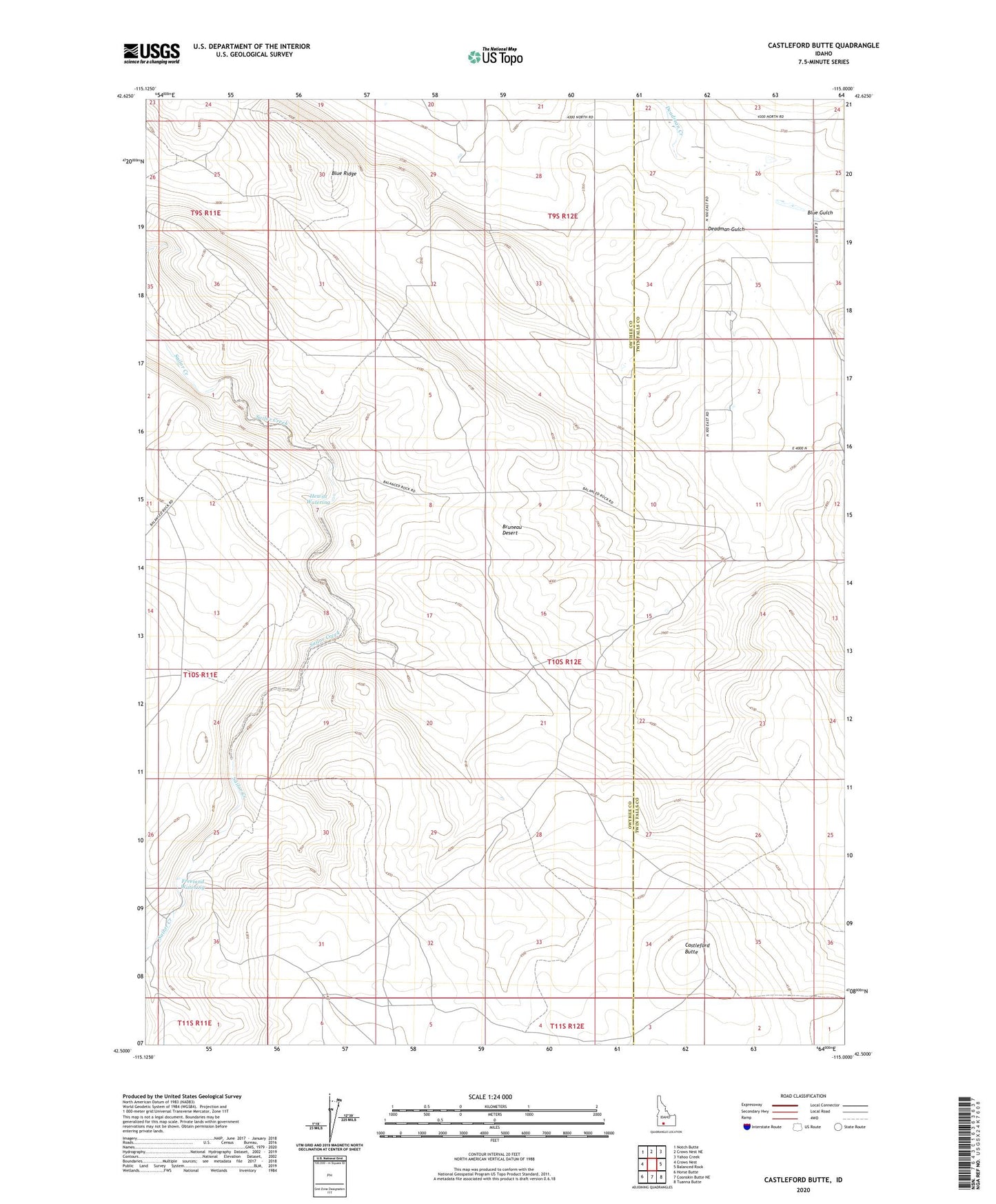
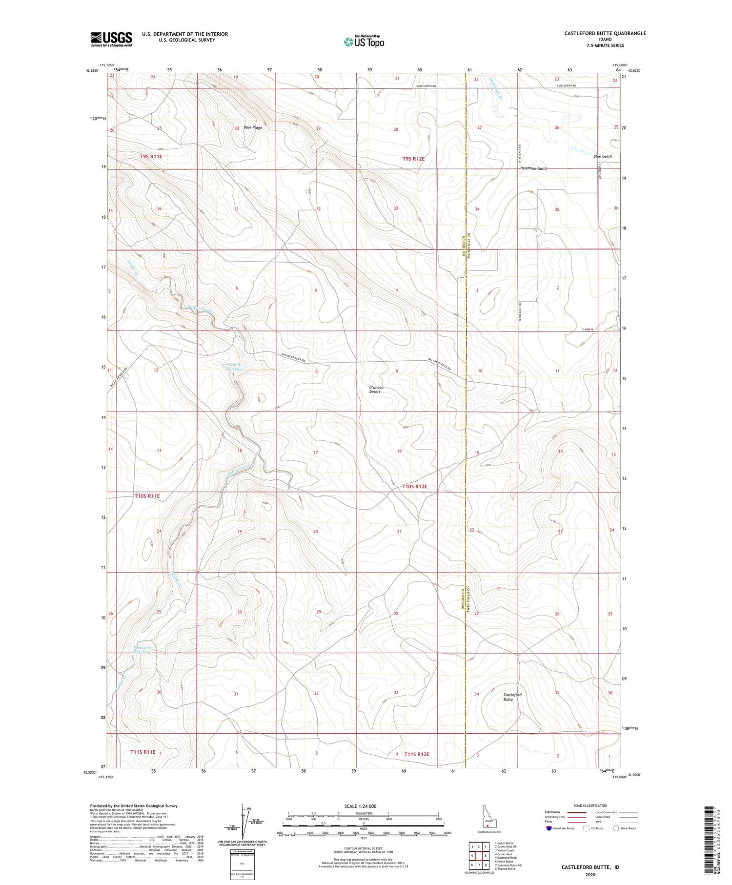
2023 topographic map quadrangle Castleford Butte in the state of Idaho. Scale: 1:24000. Based on the newly updated USGS 7.5' US Topo map series, this map is in the following counties: Owyhee, Twin Falls. The map contains contour data, water features, and other items you are used to seeing on USGS maps, but also has updated roads and other features. This is the next generation of topographic maps. Printed on high-quality waterproof paper with UV fade-resistant inks.
Quads adjacent to this one:
West: Crows Nest
Northwest: Notch Butte
North: Crows Nest NE
Northeast: Yahoo Creek
East: Balanced Rock
Southeast: Tuanna Butte
South: Coonskin Butte NE
Southwest: Horse Butte
This map covers the same area as the classic USGS quad with code o42115e1.
Contains the following named places: Blue Gulch, Blue Ridge, Castleford Butte, Deadman Gulch, Freeland Watering, Hewitt Watering