MyTopo
Challis Idaho US Topo Map
Couldn't load pickup availability
Also explore the Challis Forest Service Topo of this same quad for updated USFS data
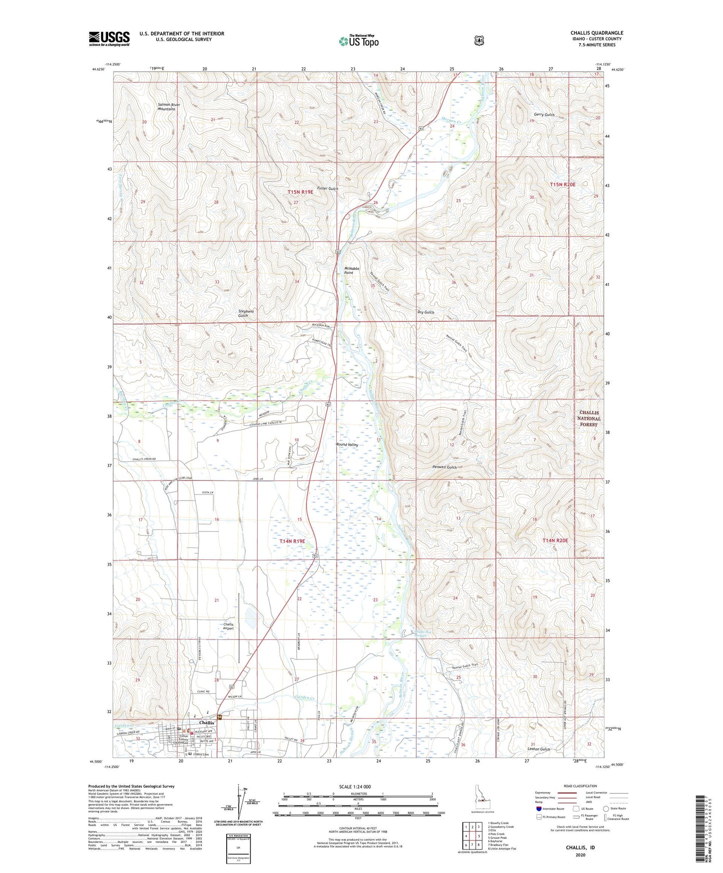
2024 topographic map quadrangle Challis in the state of Idaho. Scale: 1:24000. Based on the newly updated USGS 7.5' US Topo map series, this map is in the following counties: Custer. The map contains contour data, water features, and other items you are used to seeing on USGS maps, but also has updated roads and other features. This is the next generation of topographic maps. Printed on high-quality waterproof paper with UV fade-resistant inks.
Quads adjacent to this one:
West: Pats Creek
Northwest: Blowfly Creek
North: Gooseberry Creek
Northeast: Ellis
East: Grouse Peak
Southeast: Little Antelope Flat
South: Bradbury Flat
Southwest: Bayhorse
This map covers the same area as the classic USGS quad with code o44114e2.
Contains the following named places: Challis, Challis Airport, Challis Cemetery, Challis Creek, Challis District Ranger Station, Challis Elementary School, Challis Hot Springs, Challis Junior - Senior High School, Challis Post Office, Challis Volunteer Fire Department, City of Challis, Custer County Sheriff's Office, Darling Creek, Dry Gulch, Fuller Gulch, Garden City, Garden Creek, Gerry Gulch, Hannah Slough, Land of the Yankee Fork State Park & National Forest Historic Area, Leaton Gulch, McNabbs Point, Morgan Creek, Penal Gulch Access Area, Penwell Gulch, Round Valley, Stephens Gulch