
MyTopo
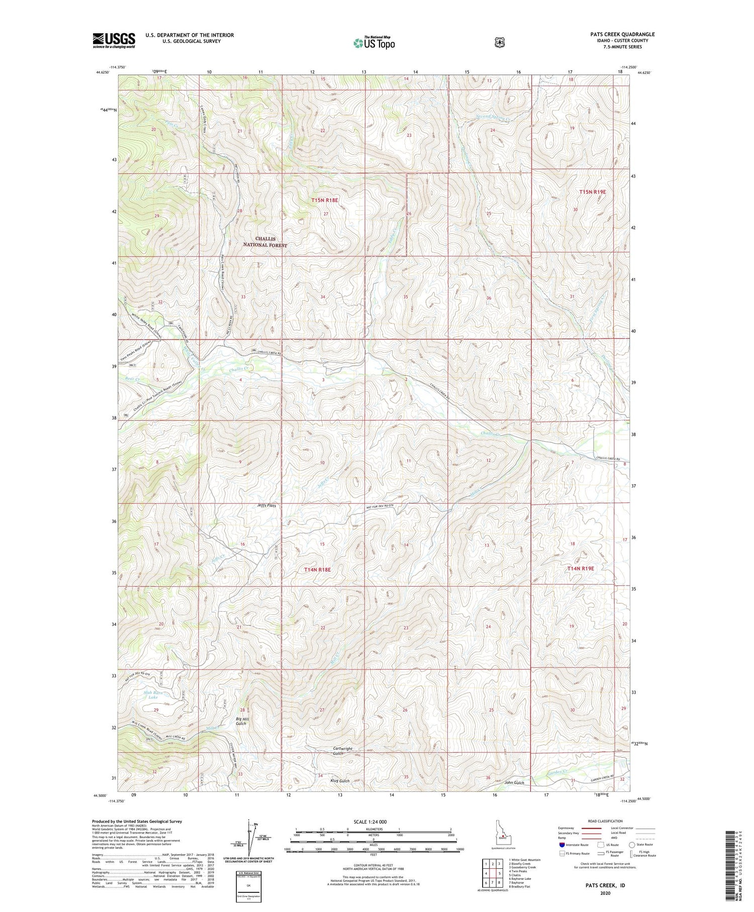
Pats Creek Idaho US Topo Map
Couldn't load pickup availability
Also explore the Pats Creek Forest Service Topo of this same quad for updated USFS data
2024 topographic map quadrangle Pats Creek in the state of Idaho. Scale: 1:24000. Based on the newly updated USGS 7.5' US Topo map series, this map is in the following counties: Custer. The map contains contour data, water features, and other items you are used to seeing on USGS maps, but also has updated roads and other features. This is the next generation of topographic maps. Printed on high-quality waterproof paper with UV fade-resistant inks.
Quads adjacent to this one:
West: Twin Peaks
Northwest: White Goat Mountain
North: Blowfly Creek
Northeast: Gooseberry Creek
East: Challis
Southeast: Bradbury Flat
South: Bayhorse
Southwest: Bayhorse Lake
This map covers the same area as the classic USGS quad with code o44114e3.
Contains the following named places: Bear Creek, Big Hill Gulch, Eddy Creek, First Spring Creek, Jeffs Creek, Jeffs Flats, Mill Creek, Pats Creek, Second Spring Creek, Slab Barn Lake, Transfer Camp, White Valley Creek


