MyTopo
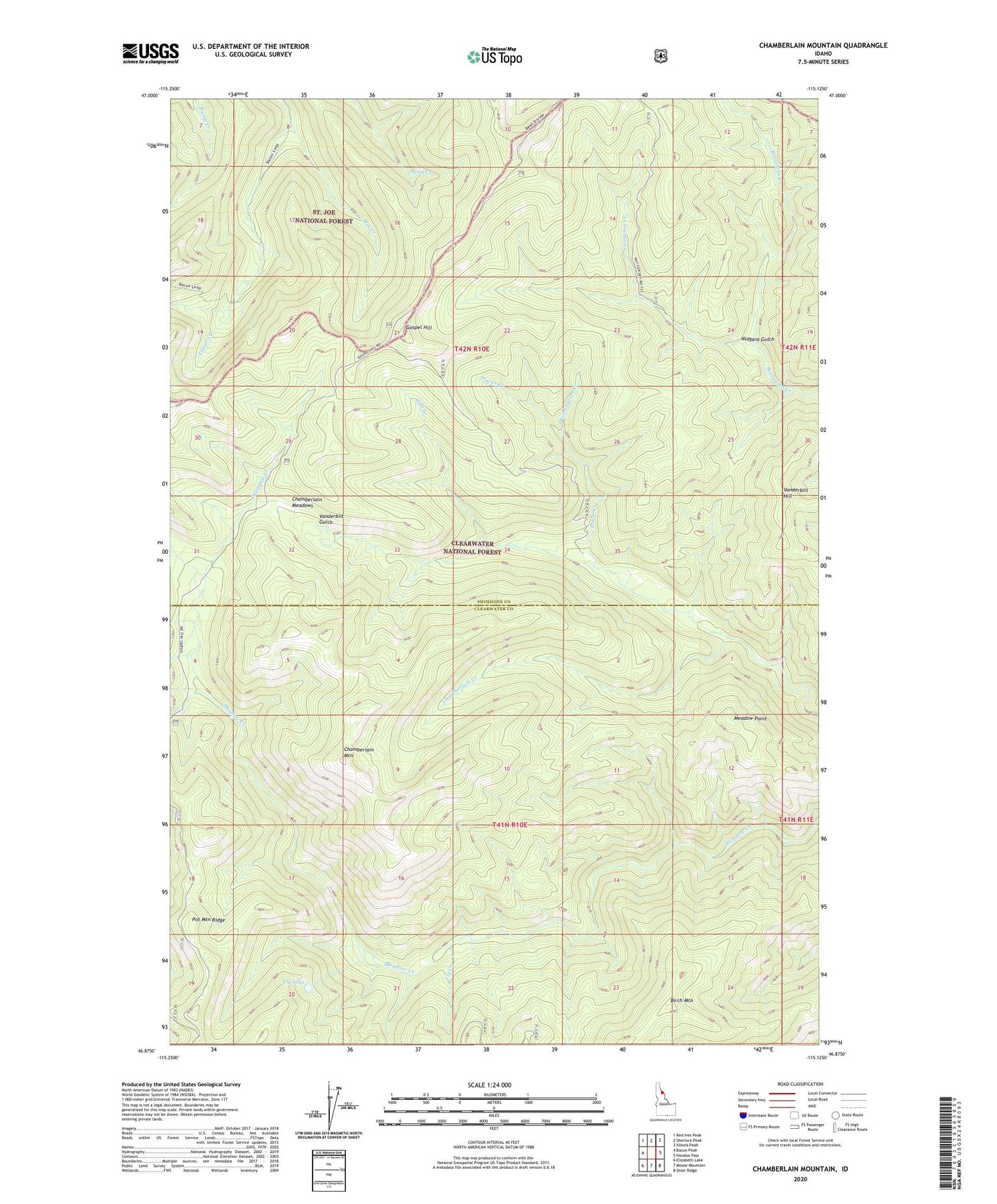
Chamberlain Mountain Idaho US Topo Map
Couldn't load pickup availability
Also explore the Chamberlain Mountain Forest Service Topo of this same quad for updated USFS data
2024 topographic map quadrangle Chamberlain Mountain in the state of Idaho. Scale: 1:24000. Based on the newly updated USGS 7.5' US Topo map series, this map is in the following counties: Shoshone, Clearwater. The map contains contour data, water features, and other items you are used to seeing on USGS maps, but also has updated roads and other features. This is the next generation of topographic maps. Printed on high-quality waterproof paper with UV fade-resistant inks.
Quads adjacent to this one:
West: Bacon Peak
Northwest: Red Ives Peak
North: Sherlock Peak
Northeast: Illinois Peak
East: Hoodoo Pass
Southeast: Osier Ridge
South: Moose Mountain
Southwest: Elizabeth Lake
This map covers the same area as the classic USGS quad with code o46115h2.
Contains the following named places: Birch Mountain, Caledonia Creek, Chamberlain Creek, Chamberlain Meadows, Chamberlain Mountain, Clearwater Mine, Dave Ingram Creek, Fall Creek, Fly Creek, Fly Lake, Gospel Hill, Klug Cabin, Meadow Point, Mill Creek, Niagara Gulch, Placer Creek, Vanderbilt Hill