MyTopo
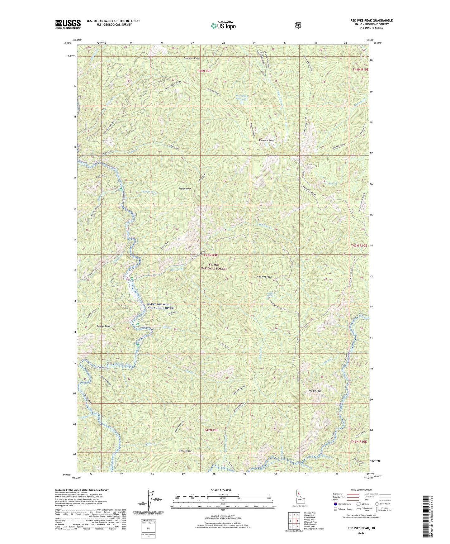
Red Ives Peak Idaho US Topo Map
Couldn't load pickup availability
Also explore the Red Ives Peak Forest Service Topo of this same quad for updated USFS data
2024 topographic map quadrangle Red Ives Peak in the state of Idaho. Scale: 1:24000. Based on the newly updated USGS 7.5' US Topo map series, this map is in the following counties: Shoshone. The map contains contour data, water features, and other items you are used to seeing on USGS maps, but also has updated roads and other features. This is the next generation of topographic maps. Printed on high-quality waterproof paper with UV fade-resistant inks.
Quads adjacent to this one:
West: Peggy Peak
Northwest: Conrad Peak
North: Berge Peak
Northeast: Torino Peak
East: Sherlock Peak
Southeast: Chamberlain Mountain
South: Bacon Peak
Southwest: Pole Mountain
This map covers the same area as the classic USGS quad with code o47115a3.
Contains the following named places: Aqua Creek, Bean Creek, Beaver Creek, Beaver Creek Campground, Bedrock Creek, Bonehead Creek, Broken Leg Creek, Broken Leg Forest Cabin, Color Creek, Copper Creek, Copper Point, Elbow Ridge, Forage Creek, Game Creek, Halm Creek, Indian Creek, Indian Peak, Line Creek, Myrtle Creek, Needle Creek, Needle Peak, Red Ives Creek, Red Ives Peak, Red Ives Ranger Station, Red Ives Spring, Scat Creek, Simmons Lookout, Simmons Peak, Simmons Ridge, Spruce Tree Campground, Swimming Bear Lake, Timber Creek