MyTopo
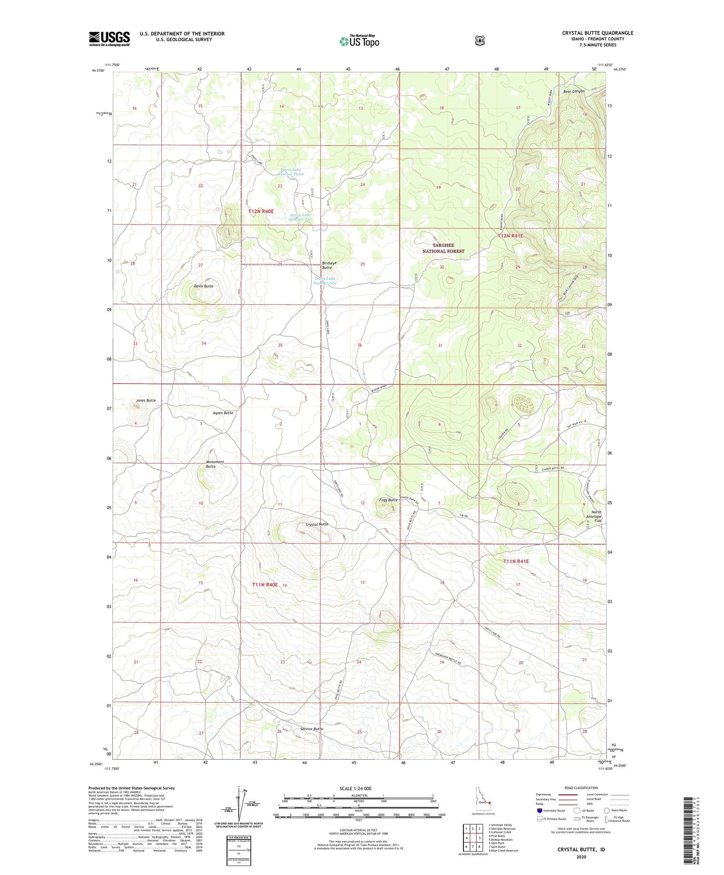
Crystal Butte Idaho US Topo Map
Couldn't load pickup availability
Also explore the Crystal Butte Forest Service Topo of this same quad for updated USFS data
2024 topographic map quadrangle Crystal Butte in the state of Idaho. Scale: 1:24000. Based on the newly updated USGS 7.5' US Topo map series, this map is in the following counties: Fremont. The map contains contour data, water features, and other items you are used to seeing on USGS maps, but also has updated roads and other features. This is the next generation of topographic maps. Printed on high-quality waterproof paper with UV fade-resistant inks.
Quads adjacent to this one:
West: Pine Butte
Northwest: Antelope Valley
North: Sheridan Reservoir
Northeast: Icehouse Creek
East: Bishop Mountain
Southeast: Blue Creek Reservoir
South: Split Butte
Southwest: Split Rock
This map covers the same area as the classic USGS quad with code o44111c6.
Contains the following named places: Aspen Butte, Bear Canyon, Birdseye Butte, Crystal Butte, Davis Butte, Davis Lake Number One, Davis Lake Number Three, Davis Lake Number Two, Fogg Butte, Fogg Butte Well, Hunting Well, Jones Butte, Monument Butte, Service Butte