MyTopo
Pine Butte Idaho US Topo Map
Couldn't load pickup availability
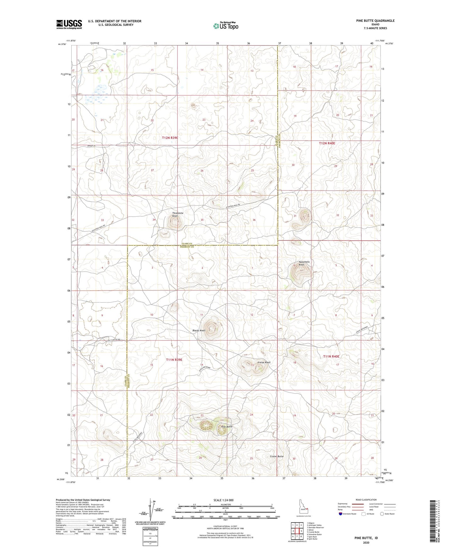
2023 topographic map quadrangle Pine Butte in the state of Idaho. Scale: 1:24000. Based on the newly updated USGS 7.5' US Topo map series, this map is in the following counties: Clark, Fremont. The map contains contour data, water features, and other items you are used to seeing on USGS maps, but also has updated roads and other features. This is the next generation of topographic maps. Printed on high-quality waterproof paper with UV fade-resistant inks.
Quads adjacent to this one:
West: Idmon
Northwest: Kilgore
North: Antelope Valley
Northeast: Sheridan Reservoir
East: Crystal Butte
Southeast: Split Butte
South: Split Rock
Southwest: Snowshoe Butte
This map covers the same area as the classic USGS quad with code o44111c7.
Contains the following named places: Bedstead Corner, Blacks Knoll, Blacks Well Number 2, Crater Butte, Freize Knoll, Pine Butte, Threemile Knoll, Twitchells Knoll