MyTopo
Driggs Idaho US Topo Map
Couldn't load pickup availability
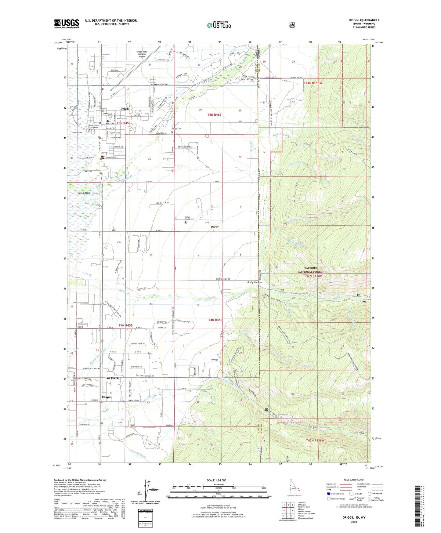
2020 topographic map quadrangle Driggs in the states of Idaho, Wyoming. Scale: 1:24000. Based on the newly updated USGS 7.5' US Topo map series, this map is in the following counties: Teton. The map contains contour data, water features, and other items you are used to seeing on USGS maps, but also has updated roads and other features. This is the next generation of topographic maps. Printed on high-quality waterproof paper with UV fade-resistant inks.
Quads adjacent to this one:
West: Bates
Northwest: Tetonia
North: Clawson
Northeast: Granite Basin
East: Mount Bannon
Southeast: Rendezvous Peak
South: Victor
Southwest: Fourth of July Peak
Contains the following named places: Chapin, Cherry Grove Canal, City of Driggs, Crandall Spring, Darby, Darby Canyon, Deadwood Creek, Driggs, Driggs - Darby Cemetery, Driggs Cemetery, Driggs Post Office, Driggs-Reed Memorial Airport, Fox Creek, Hill Creek, Nelson Spring, Rapid Creek, Rock Creek, Slocum Creek, Sorensen Creek, South Fork Hill Creek, Spring Creek, Spud Drive-In, Teton County Fire Protection District Station 1, Teton County Sheriff's Office, Teton High School, Teton Middle School, Teton Valley Hospital, Weir