MyTopo
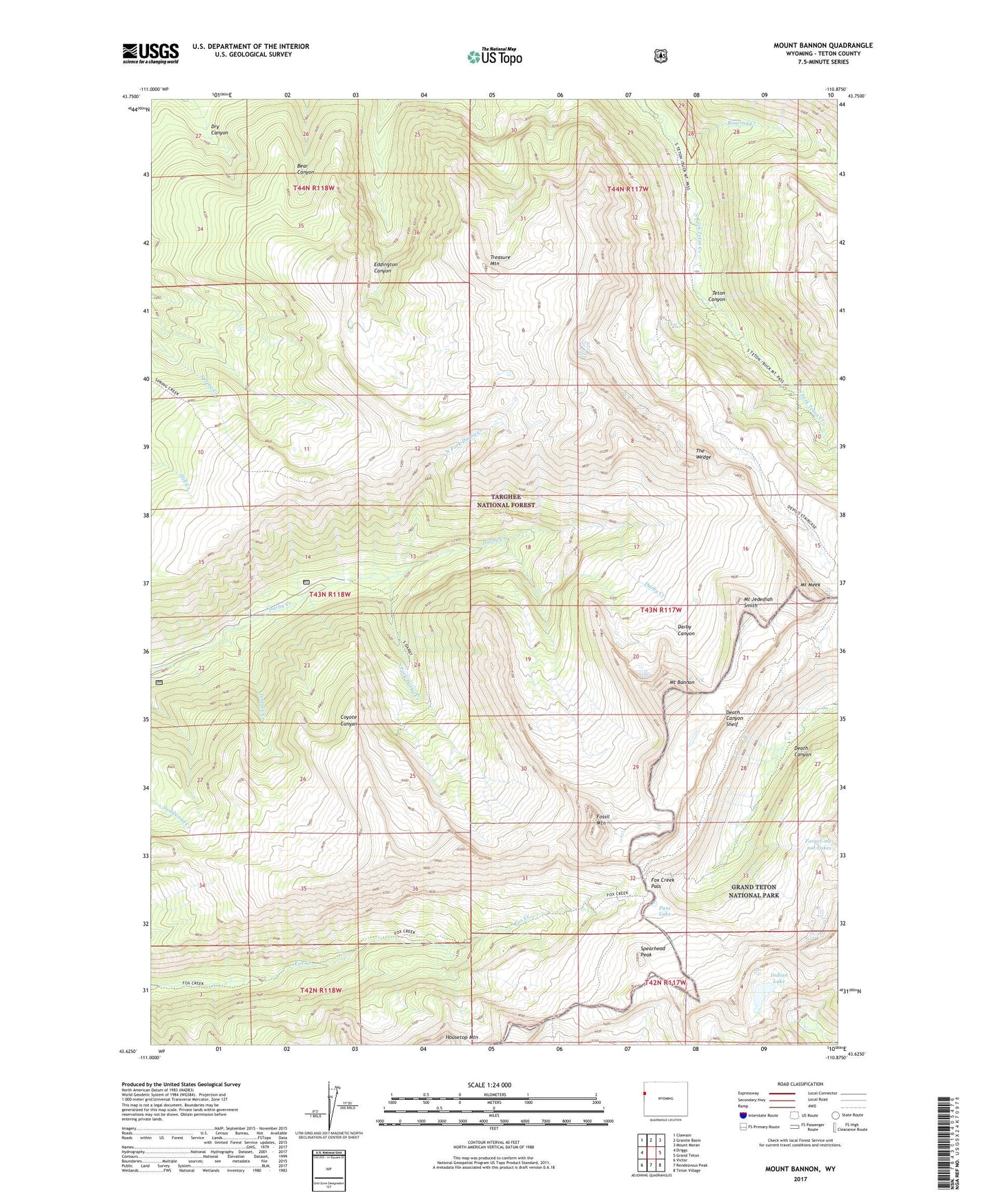
Mount Bannon Wyoming US Topo Map
Couldn't load pickup availability
Also explore the Mount Bannon Forest Service Topo of this same quad for updated USFS data
2021 topographic map quadrangle Mount Bannon in the state of Wyoming. Scale: 1:24000. Based on the newly updated USGS 7.5' US Topo map series, this map is in the following counties: Teton. The map contains contour data, water features, and other items you are used to seeing on USGS maps, but also has updated roads and other features. This is the next generation of topographic maps. Printed on high-quality waterproof paper with UV fade-resistant inks.
Quads adjacent to this one:
West: Driggs
Northwest: Clawson
North: Granite Basin
Northeast: Mount Moran
East: Grand Teton
Southeast: Teton Village
South: Rendezvous Peak
Southwest: Victor
This map covers the same area as the classic USGS quad with code o43110f8.
Contains the following named places: Alaska Basin Trail, Darby Girls Camp, Death Canyon Shelf, Devils Stairs, Fossil Mountain, Fox Creek Pass, Indian Lake, Mount Bannon, Mount Jedediah Smith, Mount Meek, North Fork Darby Creek, Pass Lake, Roaring Creek, South Fork Darby Creek, Spearhead Peak, Terrace Creek, The Wedge, Treasure Mountain