MyTopo
Elk City Idaho US Topo Map
Couldn't load pickup availability
Also explore the Elk City Forest Service Topo of this same quad for updated USFS data
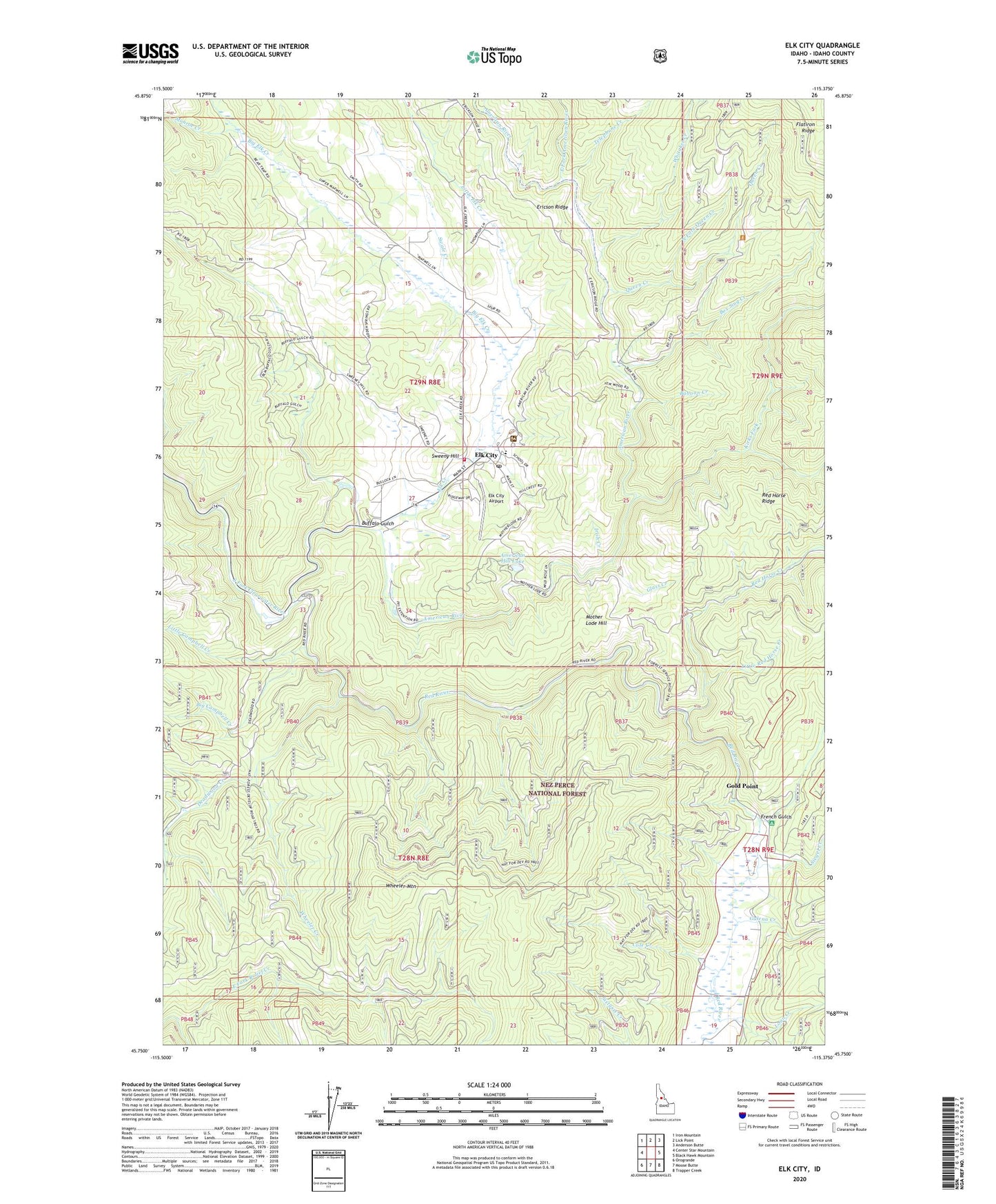
2024 topographic map quadrangle Elk City in the state of Idaho. Scale: 1:24000. Based on the newly updated USGS 7.5' US Topo map series, this map is in the following counties: Idaho. The map contains contour data, water features, and other items you are used to seeing on USGS maps, but also has updated roads and other features. This is the next generation of topographic maps. Printed on high-quality waterproof paper with UV fade-resistant inks.
Quads adjacent to this one:
West: Center Star Mountain
Northwest: Iron Mountain
North: Lick Point
Northeast: Anderson Butte
East: Black Hawk Mountain
Southeast: Trapper Creek
South: Moose Butte
Southwest: Orogrande
This map covers the same area as the classic USGS quad with code o45115g4.
Contains the following named places: Alamance Mine, American Hill Lake, American River, Baboon Creek, Beartrap Ranch, Big Campbell Creek, Big Elk Creek, Box Sing Creek, Buffalo Gulch, Buster Mine, Cal-Idaho Pit, Cole Creek, Deadwood Creek, E Manes, East Fork American River, East Fork Relief Creek, Elk City, Elk City Airport, Elk City Census Designated Place, Elk City Elementary-Junior High School, Elk City Lard Comm, Elk City Post Office, Elk City Ranger Station, Elk City Volunteer Fire Department, Elk Creek, French Gulch, Galena Creek, Glass Creek, Gold Point, Gold Point Mine, Grangeville, Grangeville Mine, Idaho County, Irish Creek, J Manes, Jones, Kirks Fork, Little Campbell Creek, Little Elk Creek, Little Red Horse Creek, Loon Creek, Maxwell, Monroe Creek, Mother Lode Hill, North Fork Queen Creek, Phelps, Queen Creek, Red Horse Creek, Red Horse Ridge, Red River, Shearer Mill, Siegel Creek, Sultan Shaft, Swale Creek, Sweeny Hill, Telephone Creek, Ulery, Wheeler Creek, Wheeler Mountain, Whitaker Creek