MyTopo
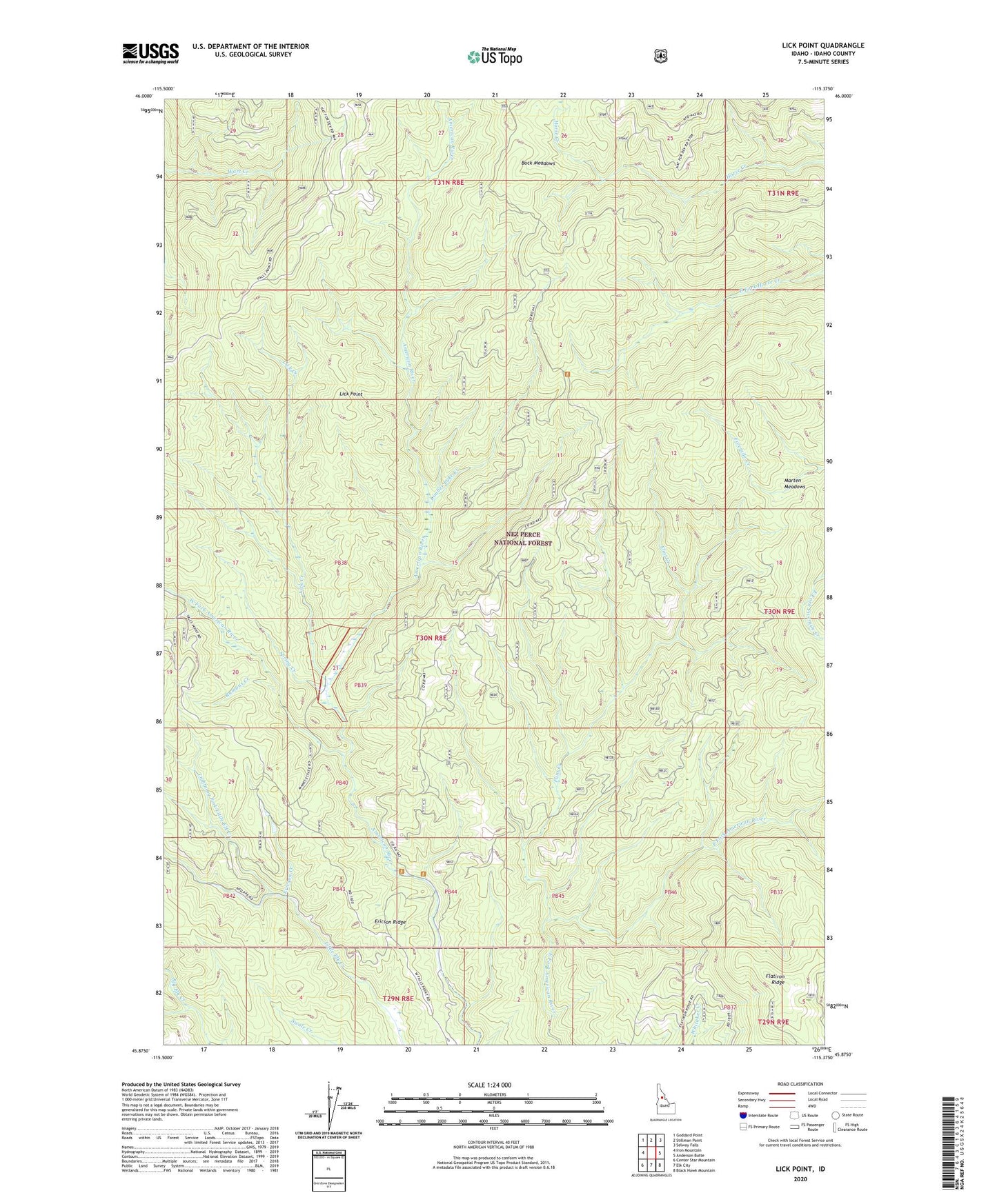
Lick Point Idaho US Topo Map
Couldn't load pickup availability
Also explore the Lick Point Forest Service Topo of this same quad for updated USFS data
2024 topographic map quadrangle Lick Point in the state of Idaho. Scale: 1:24000. Based on the newly updated USGS 7.5' US Topo map series, this map is in the following counties: Idaho. The map contains contour data, water features, and other items you are used to seeing on USGS maps, but also has updated roads and other features. This is the next generation of topographic maps. Printed on high-quality waterproof paper with UV fade-resistant inks.
Quads adjacent to this one:
West: Iron Mountain
Northwest: Goddard Point
North: Stillman Point
Northeast: Selway Falls
East: Anderson Butte
Southeast: Black Hawk Mountain
South: Elk City
Southwest: Center Star Mountain
This map covers the same area as the classic USGS quad with code o45115h4.
Contains the following named places: Buck Meadows, Ericson Creek, Flatiron Ridge, Flint Creek, Horse Creek Administrative Research Area, Horse Creek Administrative Research Site, Horse Ridge, Lick Creek, Lick Point, Lightning Fork Little Elk Creek, Limber Luke Creek, Manes Place, Marten Meadows, Rumpus Creek, Spring Creek, West Fork American River, West Fork Big Elk Creek, York