MyTopo
Frying Pan Basin Idaho US Topo Map
Couldn't load pickup availability
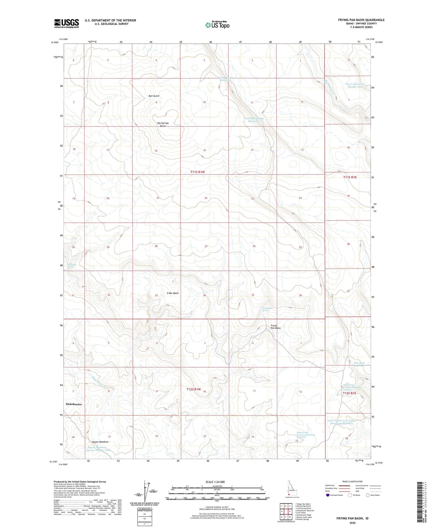
2023 topographic map quadrangle Frying Pan Basin in the state of Idaho. Scale: 1:24000. Based on the newly updated USGS 7.5' US Topo map series, this map is in the following counties: Owyhee. The map contains contour data, water features, and other items you are used to seeing on USGS maps, but also has updated roads and other features. This is the next generation of topographic maps. Printed on high-quality waterproof paper with UV fade-resistant inks.
Quads adjacent to this one:
West: Dickshooter Reservoir
Northwest: Wagon Box Basin
North: Big Springs Ranch
Northeast: Crab Spring Butte
East: Lost Valley
Southeast: Shoofly Springs
South: Battle Creek Lakes
Southwest: Dickshooter Ridge
This map covers the same area as the classic USGS quad with code o42116d4.
Contains the following named places: Avandale Spring, Battle Creek Crossing Waterhole Number 1, Battle Creek Crossing Waterhole Number 2, Big Springs Butte, D Bar Basin, Dry Creek Reservoir Number Five, Dry Forty, Frying Pan Basin, Frying Pan Spring, Lower Battle Creek Crossing Reservoir Number 1, Rim Rock Reservoir, South Bench Reservoir, South Big Springs Reservoir, Squaw Meadows Reservoir Number One