MyTopo
Wagon Box Basin Idaho US Topo Map
Couldn't load pickup availability
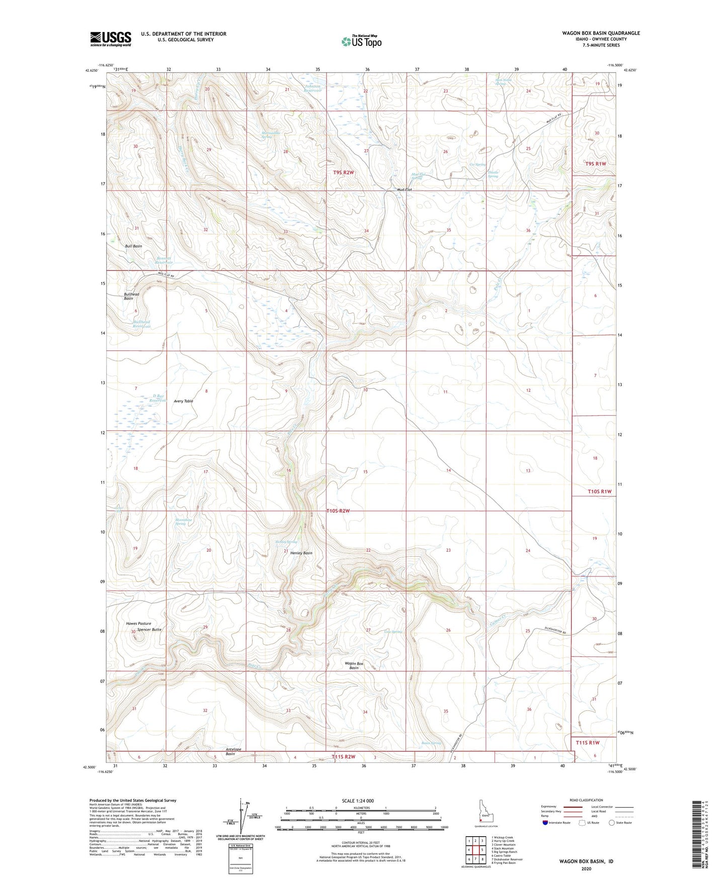
2023 topographic map quadrangle Wagon Box Basin in the state of Idaho. Scale: 1:24000. Based on the newly updated USGS 7.5' US Topo map series, this map is in the following counties: Owyhee. The map contains contour data, water features, and other items you are used to seeing on USGS maps, but also has updated roads and other features. This is the next generation of topographic maps. Printed on high-quality waterproof paper with UV fade-resistant inks.
Quads adjacent to this one:
West: Slack Mountain
Northwest: Wickiup Creek
North: Hurry Up Creek
Northeast: Clover Mountain
East: Big Springs Ranch
Southeast: Frying Pan Basin
South: Dickshooter Reservoir
Southwest: Castro Table
This map covers the same area as the classic USGS quad with code o42116e5.
Contains the following named places: Avery Table, Basin Spring, Bennett Reservoir, Bull Basin, Bullhead Basin, Bullhead Reservoir, Burton Dam, Camas Creek, Camel Falls, Ccc Spring, Cow Spring, D Bar Reservoir, Hawes Pasture, Henley Basin, Henley Spring, Hurry Up Creek, Johnson Reservoir, Johnston Cabin, Marmaduke Spring, Moonshine Spring, Mud Flat, Mud Flat Spring, Pole Creek Wilderness, Sam Noble Spring, Spencer Butte, Thistle Spring, Wagon Box Basin