MyTopo
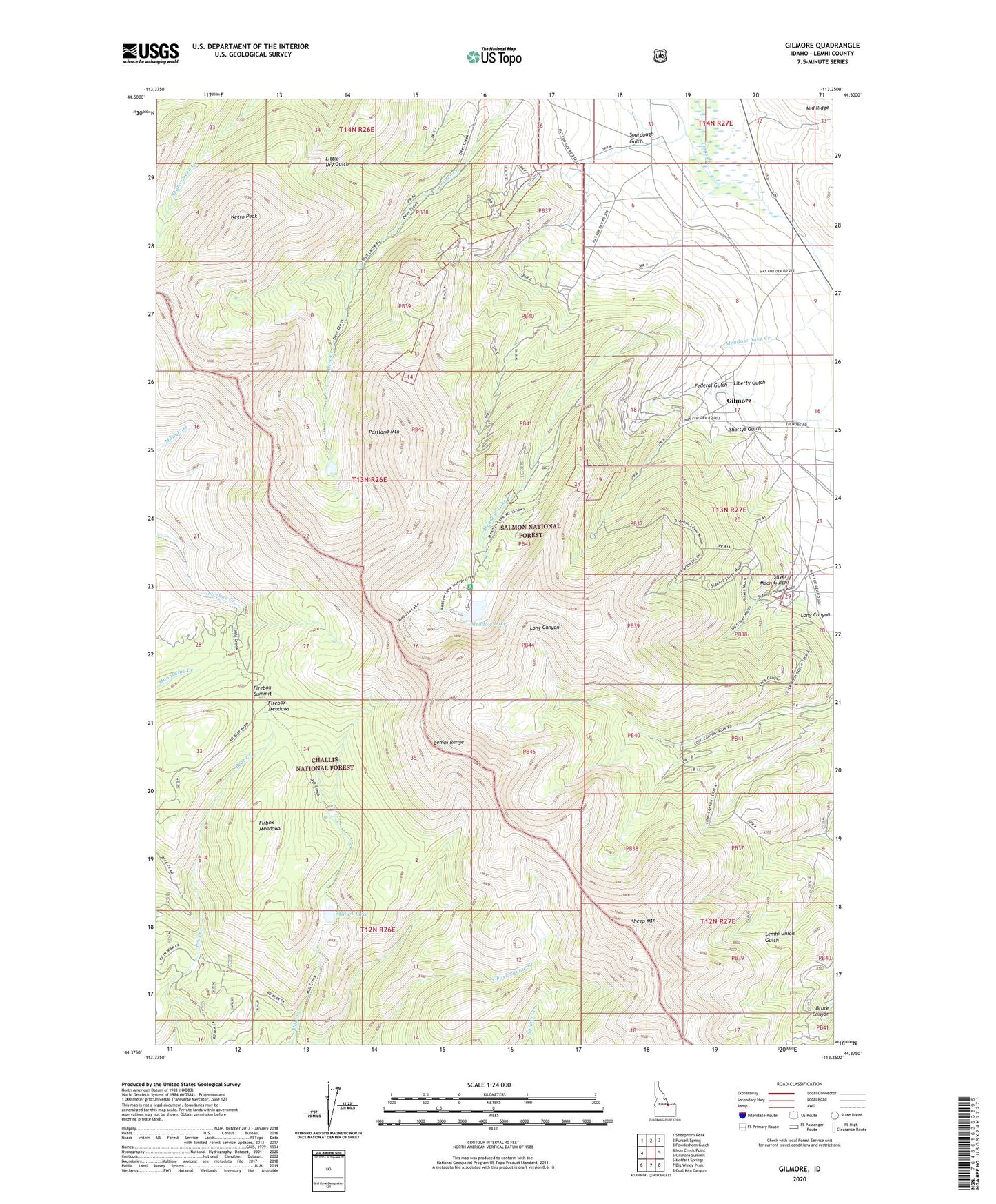
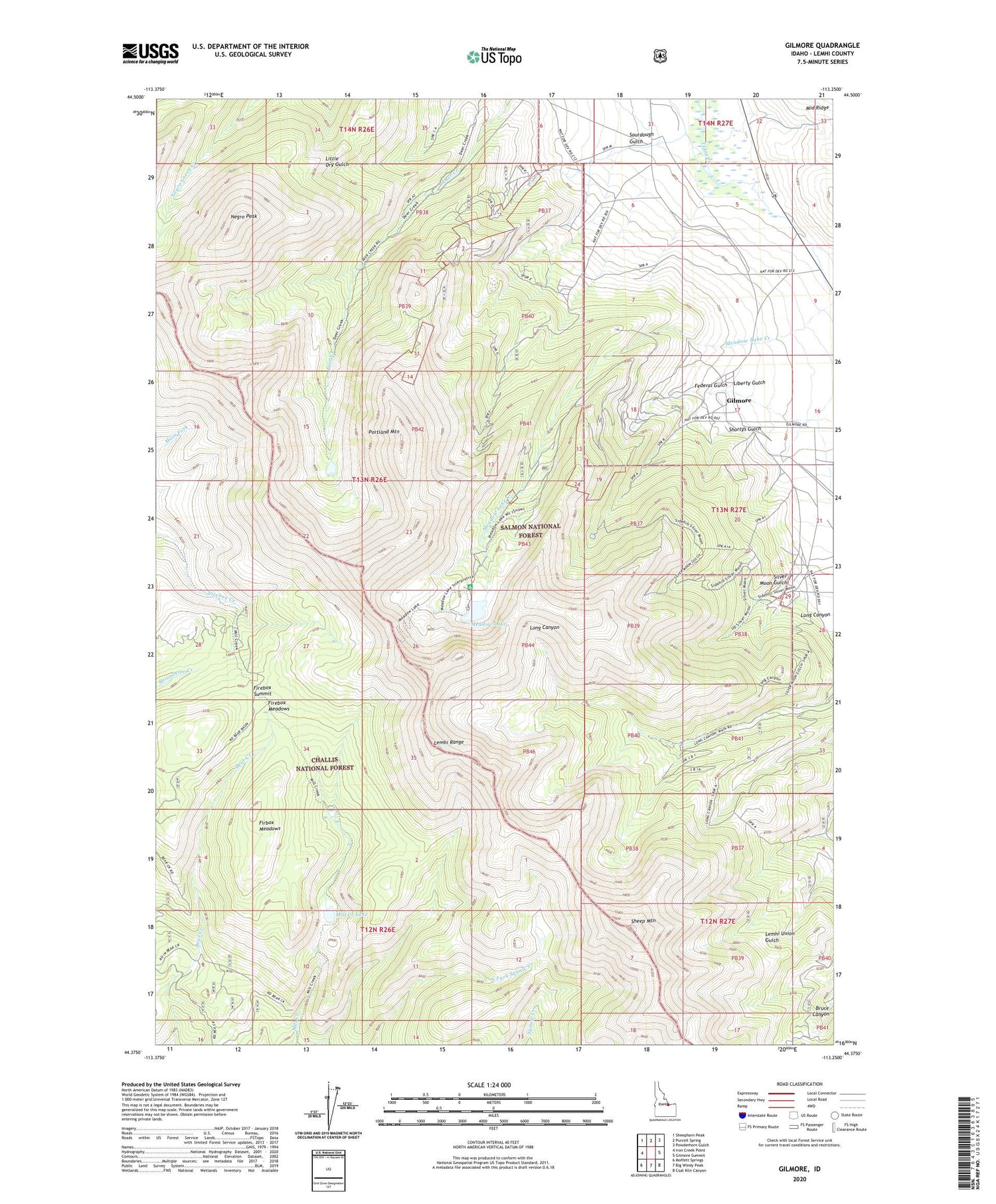
Gilmore Idaho US Topo Map
Couldn't load pickup availability
Also explore the Gilmore Forest Service Topo of this same quad for updated USFS data
2023 topographic map quadrangle Gilmore in the state of Idaho. Scale: 1:24000. Based on the newly updated USGS 7.5' US Topo map series, this map is in the following counties: Lemhi. The map contains contour data, water features, and other items you are used to seeing on USGS maps, but also has updated roads and other features. This is the next generation of topographic maps. Printed on high-quality waterproof paper with UV fade-resistant inks.
Quads adjacent to this one:
West: Iron Creek Point
Northwest: Sheephorn Peak
North: Purcell Spring
Northeast: Powderhorn Gulch
East: Gilmore Summit
Southeast: Coal Kiln Canyon
South: Big Windy Peak
Southwest: Moffett Springs
This map covers the same area as the classic USGS quad with code o44113d3.
Contains the following named places: Brown Bull Mine, Federal Gulch, Firbox Meadows, Firebox Meadows, Firebox Summit, Gilmore, Gilmore Cemetery, Hilltop Mine, Iron Dyke Mine, Latest Out Mine, Liberty Gulch, Meadow Lake, Meadow Lake Campground, Meadow Lake Creek, Mill Creek Lake, Mountain Boy Mine, Negro Peak, Portland Mine, Portland Mountain, Ridgeway Mine, Sheep Mountain, Shortys Gulch, Silver Moon Gulch, Sourdough Gulch