MyTopo
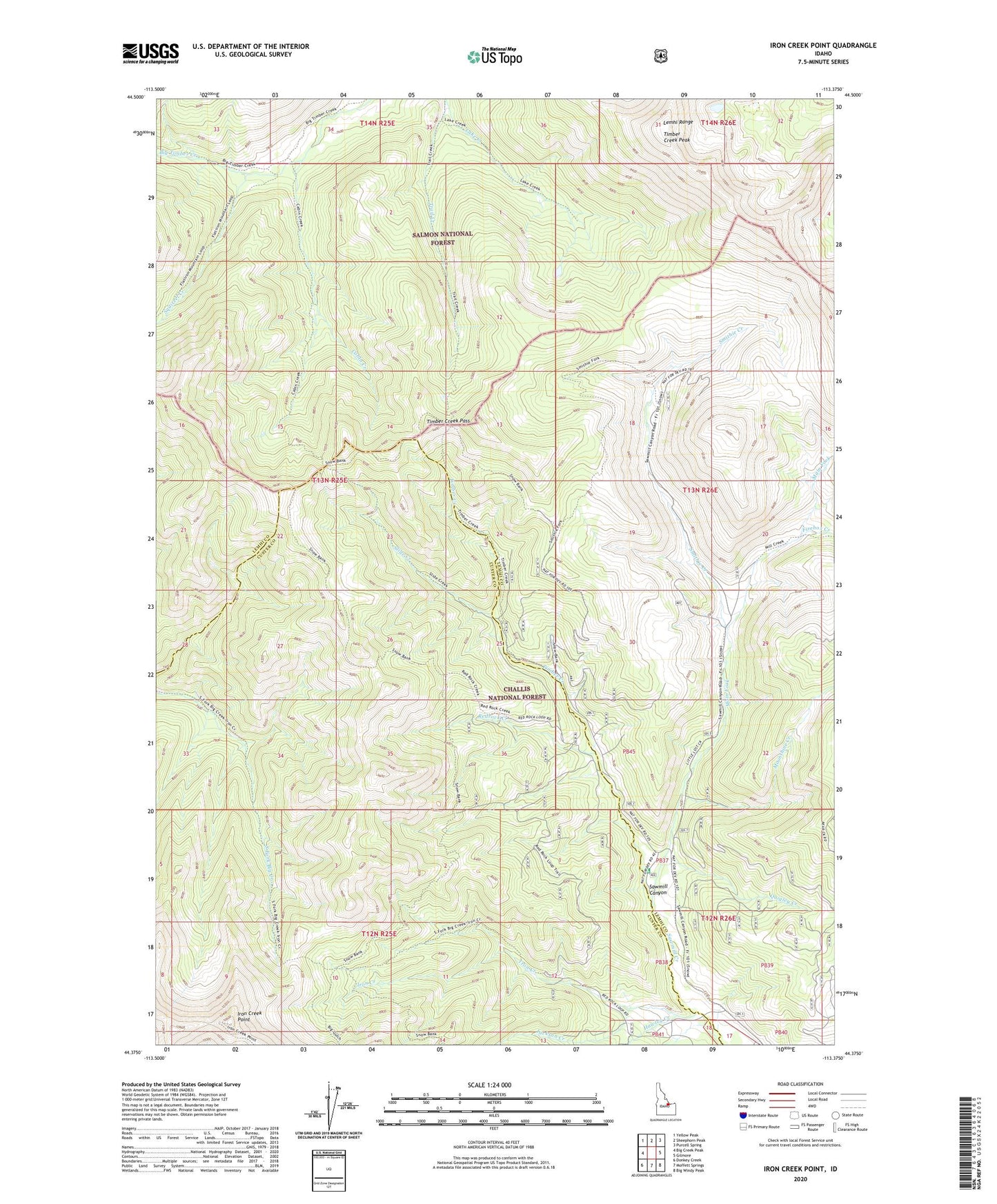
Iron Creek Point Idaho US Topo Map
Couldn't load pickup availability
Also explore the Iron Creek Point Forest Service Topo of this same quad for updated USFS data
2023 topographic map quadrangle Iron Creek Point in the state of Idaho. Scale: 1:24000. Based on the newly updated USGS 7.5' US Topo map series, this map is in the following counties: Lemhi, Custer. The map contains contour data, water features, and other items you are used to seeing on USGS maps, but also has updated roads and other features. This is the next generation of topographic maps. Printed on high-quality waterproof paper with UV fade-resistant inks.
Quads adjacent to this one:
West: Big Creek Peak
Northwest: Yellow Peak
North: Sheephorn Peak
Northeast: Purcell Spring
East: Gilmore
Southeast: Big Windy Peak
South: Moffett Springs
Southwest: Donkey Creek
This map covers the same area as the classic USGS quad with code o44113d4.
Contains the following named places: Cabin Creek, Firebox Creek, Hawley Creek, Iron Creek, Iron Creek Point, Jackson Creek, Lake Creek, Main Fork, Moonshine Creek, Quigley Creek, Redrock Creek, Slide Creek, Smithie Creek, Snowbank Trail, South Fork Big Creek, Squirrel Creek, Timber Creek, Timber Creek Pass, Timber Creek Peak