
MyTopo
Hagerman Idaho US Topo Map
Couldn't load pickup availability
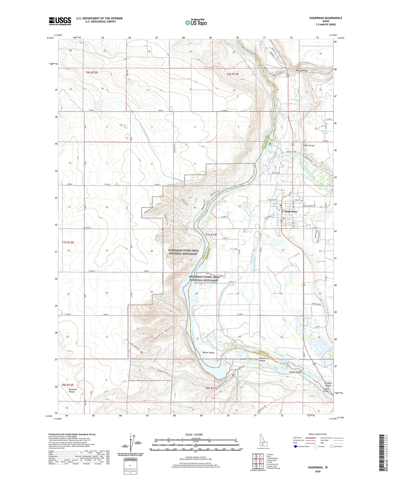
2024 topographic map quadrangle Hagerman in the state of Idaho. Scale: 1:24000. Based on the newly updated USGS 7.5' US Topo map series, this map is in the following counties: Twin Falls, Gooding. The map contains contour data, water features, and other items you are used to seeing on USGS maps, but also has updated roads and other features. This is the next generation of topographic maps. Printed on high-quality waterproof paper with UV fade-resistant inks.
Quads adjacent to this one:
West: Indian Butte
Northwest: Ticeska
North: Bliss
Northeast: Gooding Butte
East: Tuttle
Southeast: Thousand Springs
South: Yahoo Creek
Southwest: Crows Nest NE
This map covers the same area as the classic USGS quad with code o42114g8.
Contains the following named places: Bell Ditch, Bell Rapids, Bell Rapids Access Area, Big Bend Ditch, Billingsley Creek, Billingsley Creek Wildlife Management Area, Birch Creek, Brailsford Ditch, Buckeye Ditch, Buckeye Ranch, City of Hagerman, Curren Ditch, Devils Washbasin, Dolman Island, Dolman Rapids, Florence Spring, Fossil Gulch, Fossil Gulch Canal, Gridley Bridge, Gridley Island, Hagerman, Hagerman City Hall, Hagerman City Park, Hagerman Division, Hagerman Elementary School, Hagerman Fire Protection District, Hagerman Fossil Beds National Monument, Hagerman Junior-Senior High School, Hagerman Post Office, Hagerman School, Hagerman Wildlife Management Area, Hunt Ditch, Justice Grade, Lower Salmon Falls, Lower Salmon Falls Dam, Malad Gorge, Malad Gorge State Park, Malad River, Millet Island, Owsley Bridge, Owsley Bridge Access Area, Peters Gulch, Pipeline Ditch, Salmon Falls, Sands Ditch, Upper Salmon Falls, Upper Salmon Falls Dam, Upper Salmon Falls Reservoir, Yahoo Creek, ZIP Code: 83332


