MyTopo
Bliss Idaho US Topo Map
Couldn't load pickup availability
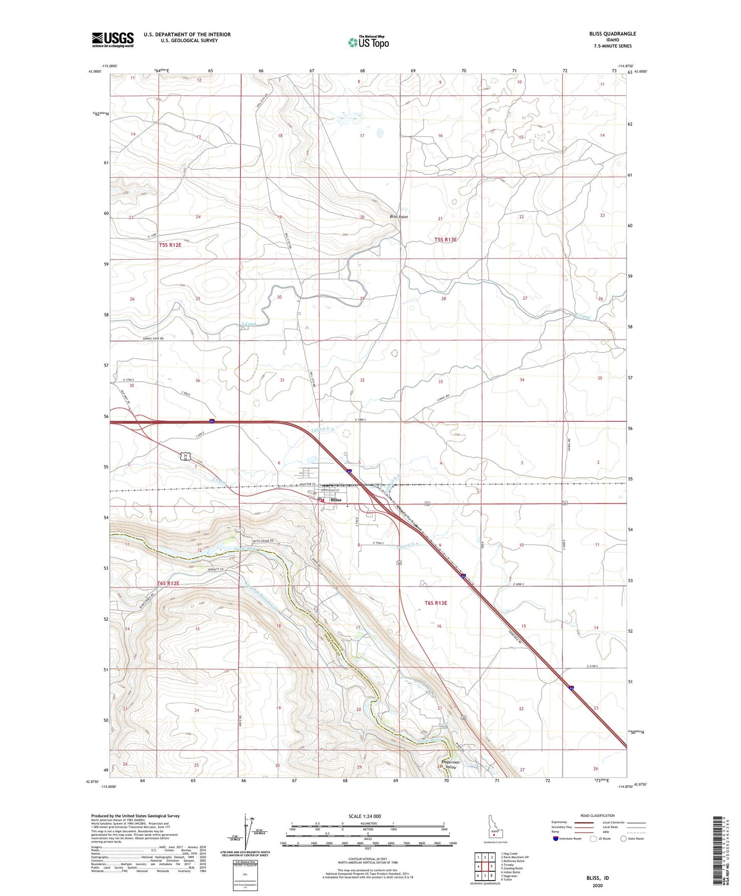
2024 topographic map quadrangle Bliss in the state of Idaho. Scale: 1:24000. Based on the newly updated USGS 7.5' US Topo map series, this map is in the following counties: Gooding, Twin Falls. The map contains contour data, water features, and other items you are used to seeing on USGS maps, but also has updated roads and other features. This is the next generation of topographic maps. Printed on high-quality waterproof paper with UV fade-resistant inks.
Quads adjacent to this one:
West: Ticeska
Northwest: Hog Creek
North: Davis Mountain SW
Northeast: McKinney Butte
East: Gooding Butte
Southeast: Tuttle
South: Hagerman
Southwest: Indian Butte
This map covers the same area as the classic USGS quad with code o42114h8.
Contains the following named places: Bliss, Bliss Community Church, Bliss Fire District Station, Bliss Point, Bliss Post Office, Bliss Public School, Bliss Quick Response, Bliss School, City of Bliss, Last Chance Reservoir, Lateral Y-4, Lateral Z-4, Lateral Z-6, North Bliss Well, Pioneer Cemetery, Windmill Well, Y Canal, Z Canal, ZIP Code: 83314