MyTopo
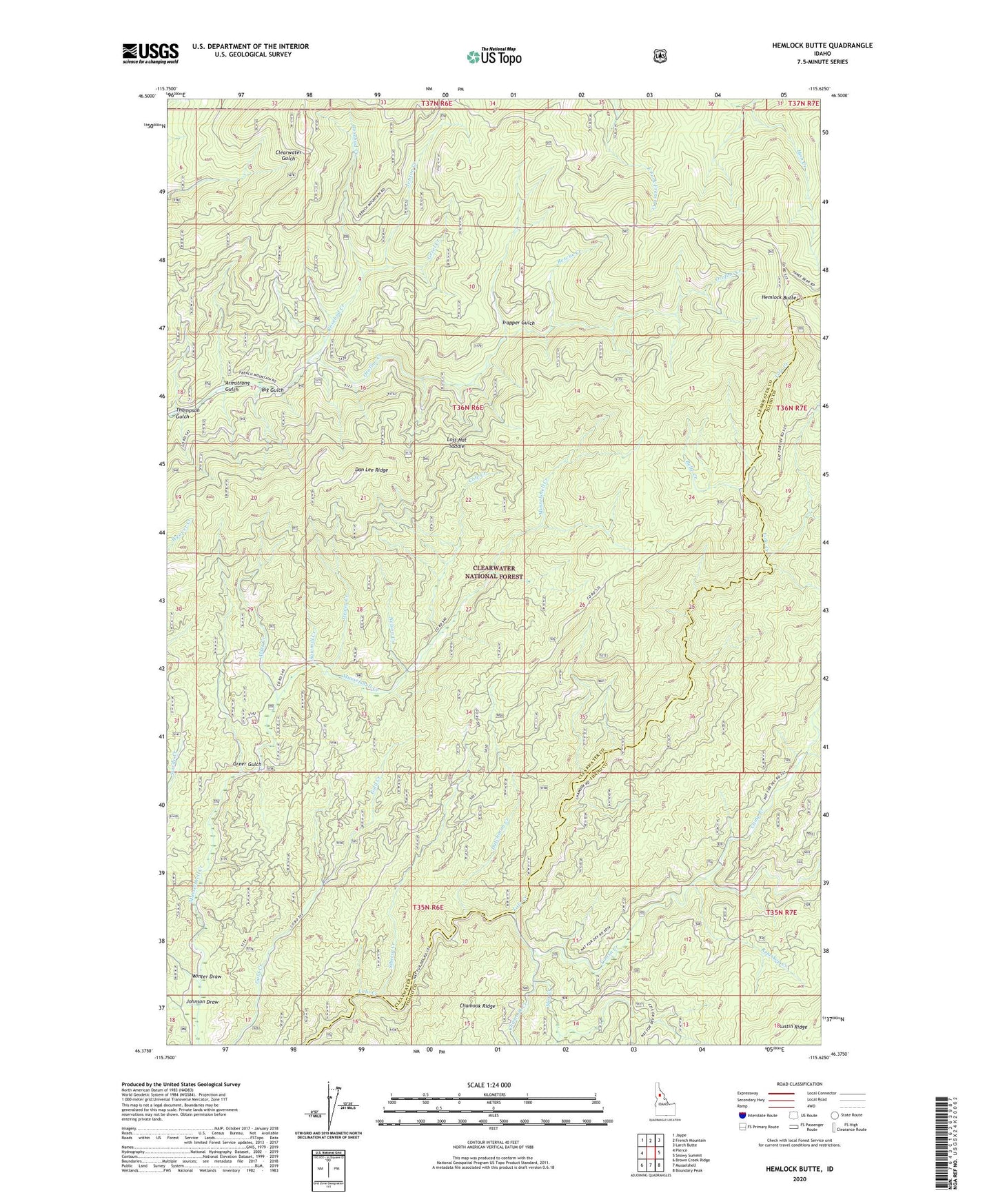
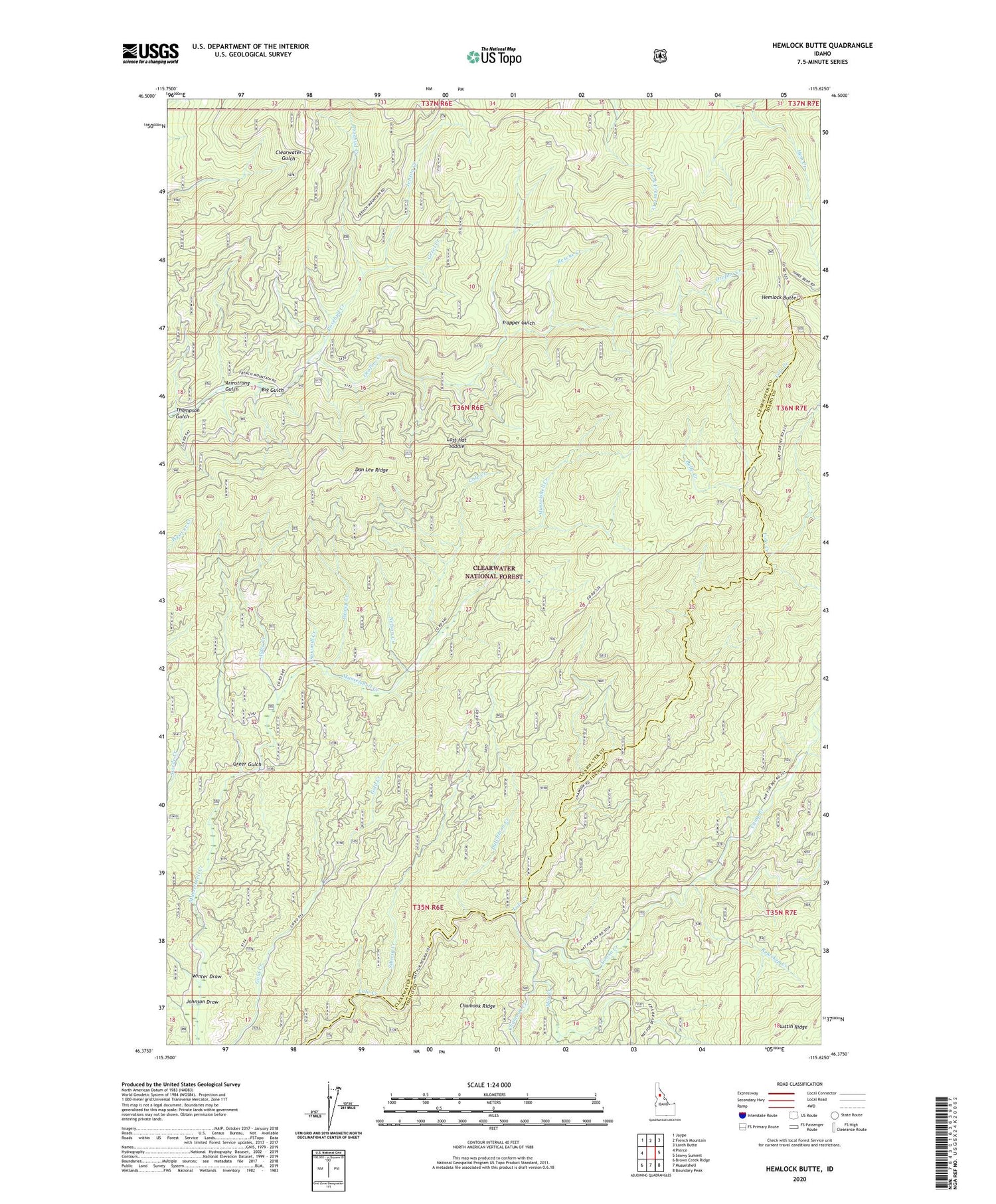
Hemlock Butte Idaho US Topo Map
Couldn't load pickup availability
Also explore the Hemlock Butte Forest Service Topo of this same quad for updated USFS data
2024 topographic map quadrangle Hemlock Butte in the state of Idaho. Scale: 1:24000. Based on the newly updated USGS 7.5' US Topo map series, this map is in the following counties: Clearwater, Idaho. The map contains contour data, water features, and other items you are used to seeing on USGS maps, but also has updated roads and other features. This is the next generation of topographic maps. Printed on high-quality waterproof paper with UV fade-resistant inks.
Quads adjacent to this one:
West: Pierce
Northwest: Jaype
North: French Mountain
Northeast: Larch Butte
East: Snowy Summit
Southeast: Boundary Peak
South: Musselshell
Southwest: Brown Creek Ridge
This map covers the same area as the classic USGS quad with code o46115d6.
Contains the following named places: Alder Creek, Armstrong Gulch, Belle Creek, Belle Creek Campground, Big Gulch, Camp Creek, Chamook Creek, Cole Creek, Dan Lee Ridge, Dewey Creek, Dutchman Creek, French Saddle, Gezel Creek, Greer Gulch, Hemlock Butte, Jenson Creek, Johnson Draw, Lost Hat Saddle, Mox Creek, Nelson Creek, Pioneer Mine, Pistol Grip Mine, Red Cloud Mine, Relaskop Creek, Rescue Creek, Rosebud Creek, Sawmill Creek, Siberia Creek, Thompson Gulch, Trapper Gulch, Winter Draw, Yoosa Creek