MyTopo
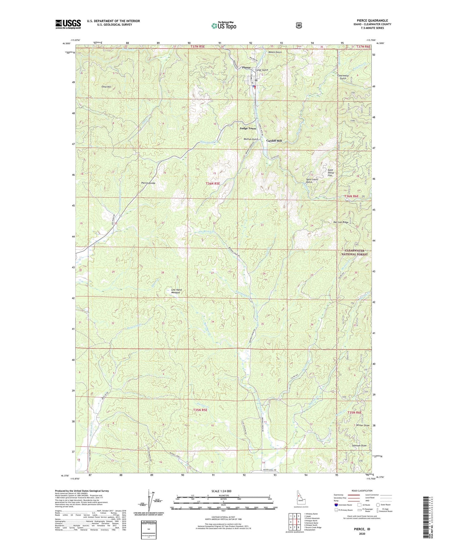
Pierce Idaho US Topo Map
Couldn't load pickup availability
Also explore the Pierce Forest Service Topo of this same quad for updated USFS data
2024 topographic map quadrangle Pierce in the state of Idaho. Scale: 1:24000. Based on the newly updated USGS 7.5' US Topo map series, this map is in the following counties: Clearwater. The map contains contour data, water features, and other items you are used to seeing on USGS maps, but also has updated roads and other features. This is the next generation of topographic maps. Printed on high-quality waterproof paper with UV fade-resistant inks.
Quads adjacent to this one:
West: Weippe North
Northwest: Whiskey Butte
North: Jaype
Northeast: French Mountain
East: Hemlock Butte
Southeast: Musselshell
South: Brown Creek Ridge
Southwest: Weippe South
This map covers the same area as the classic USGS quad with code o46115d7.
Contains the following named places: Bat Creek, Brown Creek Mill, Brown Creek Moto Cross Area, Burcham Creek, Canal Gulch, Canal Gulch Creek, Cardiff Mill, City of Pierce, Clearwater Gulch, Clearwater Gulch Picnic Area, Dan Lee Creek, Flat Creek, Fohl Picnic Area, Gold Dollar Flat, Gold Hill, Hanging Trees Historical Marker, Hildebrand Creek, Judge Town, Lew Hand Meadow, Lost Creek, Moore Gulch, Mutton Gulch, Oro Fino, Peterson Corners, Pierce, Pierce Divide, Pierce Elementary School, Pierce Middle School, Pierce Police Department, Pierce Post Office, Pierce Volunteer Fire Department, Pierce Work Center, Pierson Creek, Preacher Creek, Quartz Creek, Rhodes Creek, Saint Louis Gulch, Sourdough Creek, Swede Creek, Weaver Creek