MyTopo
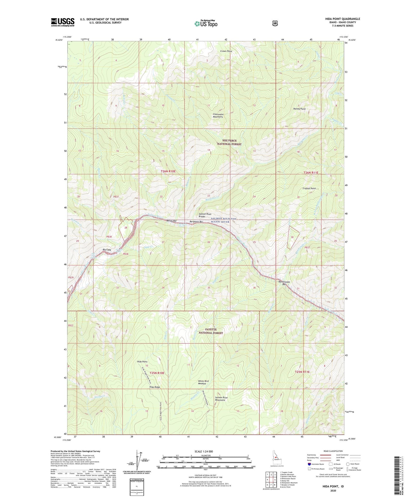
Hida Point Idaho US Topo Map
Couldn't load pickup availability
Also explore the Hida Point Forest Service Topo of this same quad for updated USFS data
2024 topographic map quadrangle Hida Point in the state of Idaho. Scale: 1:24000. Based on the newly updated USGS 7.5' US Topo map series, this map is in the following counties: Idaho. The map contains contour data, water features, and other items you are used to seeing on USGS maps, but also has updated roads and other features. This is the next generation of topographic maps. Printed on high-quality waterproof paper with UV fade-resistant inks.
Quads adjacent to this one:
West: Whitewater Ranch
Northwest: Trapper Creek
North: Boston Mountain
Northeast: Spread Creek Point
East: Sheep Hill
Southeast: Arctic Point
South: Meadow of Doubt
Southwest: Sheepeater Mountain
This map covers the same area as the classic USGS quad with code o45115e2.
Contains the following named places: Allison Ranch, Bailey Bar, Bailey Creek, Bargamin Bar, Bargamin Bar Campsite, Bargamin Creek, Bargamin Rapids, Big Eddy, Clearwater Mountains, Cliff Creek, Cro Creek, Crofoot Point, Crofoot Ranch, Crow Creek, Crown Point, Fivemile Creek, Fivemile Rapids, Hida Creek, Hida Point, Ladder Creek, Magpie Creek, Magpie Creek Campsite, Magpie Creek District Ranger Station, Myers Creek, Rainey Creek, Rainey Point, Rattlesnake Bar, Rattlesnake Creek, Raven Creek, Salmon River Breaks, Salt Creek, Sapp Creek, Silge Creek, Split Rock Rapids, West Fork Rattlesnake Creek, White Bird Meadow