MyTopo
Sheepeater Mountain Idaho US Topo Map
Couldn't load pickup availability
Also explore the Sheepeater Mountain Forest Service Topo of this same quad for updated USFS data
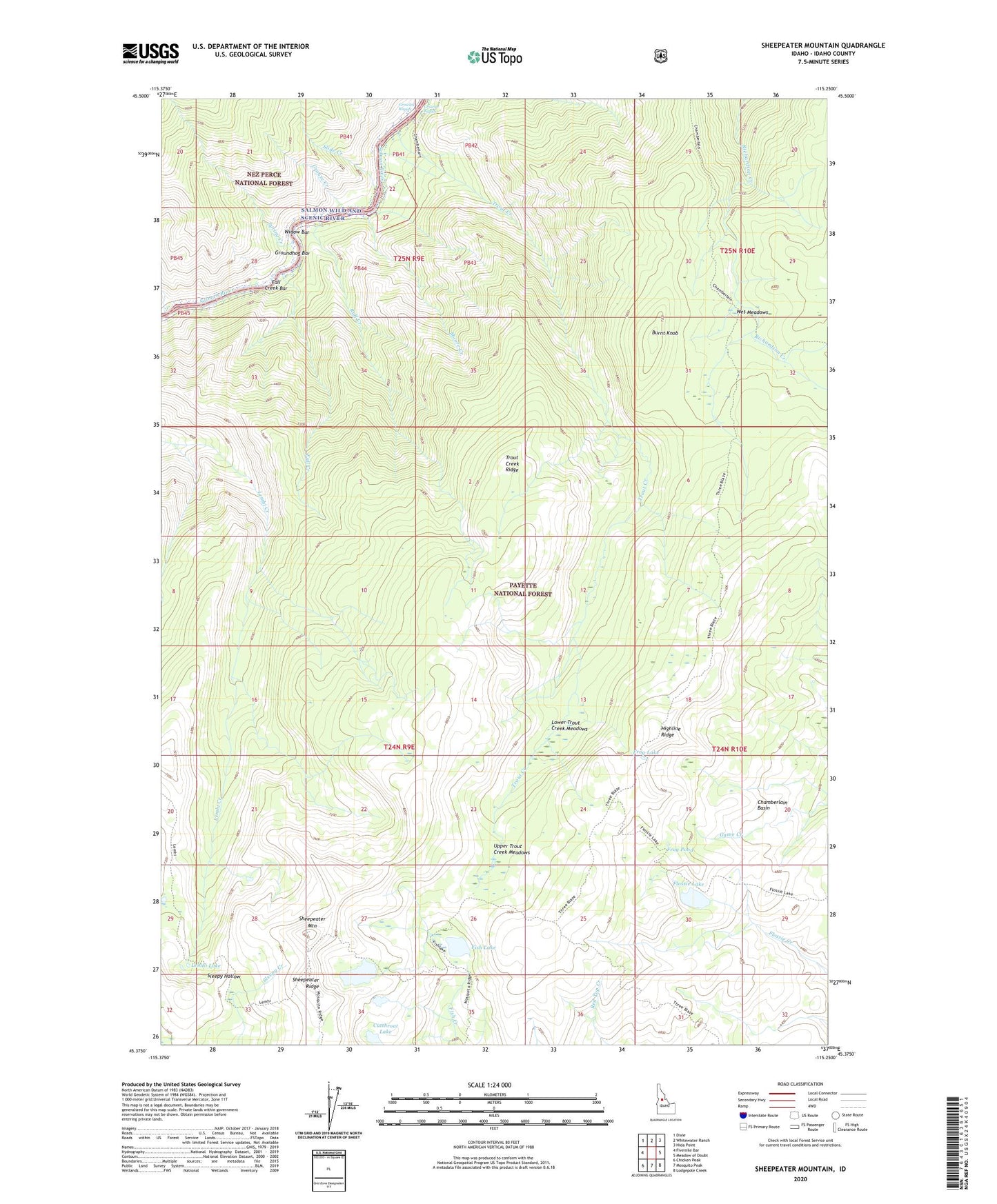
2024 topographic map quadrangle Sheepeater Mountain in the state of Idaho. Scale: 1:24000. Based on the newly updated USGS 7.5' US Topo map series, this map is in the following counties: Idaho. The map contains contour data, water features, and other items you are used to seeing on USGS maps, but also has updated roads and other features. This is the next generation of topographic maps. Printed on high-quality waterproof paper with UV fade-resistant inks.
Quads adjacent to this one:
West: Fivemile Bar
Northwest: Dixie
North: Whitewater Ranch
Northeast: Hida Point
East: Meadow of Doubt
Southeast: Lodgepole Creek
South: Mosquito Peak
Southwest: Chicken Peak
This map covers the same area as the classic USGS quad with code o45115d3.
Contains the following named places: Burnt Knob, Cambell Ferry Airstrip, Campbells Ferry, Cutthroat Lake, Fall Creek, Fall Creek Bar, Fish Lake, Flossie Lake, Frog Lake, Frog Pond, Groundhog Bar, Grouse Creek, Highline Ridge, Jim Moore Place, Lemhi Lake, Lower Trout Creek Meadows, Moore Creek, Reed Creek, Ruff Creek, Shake Cabin, Sheepeater Lake, Sheepeater Mountain, Sleepy Hollow, Slide Creek, Spring Creek, Three Blaze Trail, Trout Creek, Trout Creek Ridge, Upper Trout Creek Meadows, Wet Meadows, Widow Bar