MyTopo
Indian Cove Idaho US Topo Map
Couldn't load pickup availability
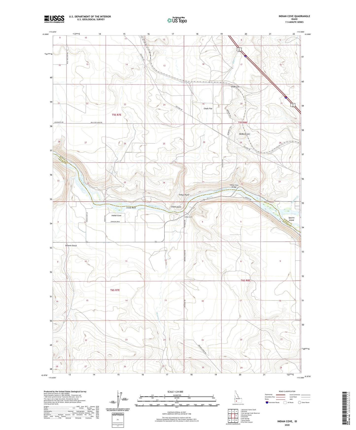
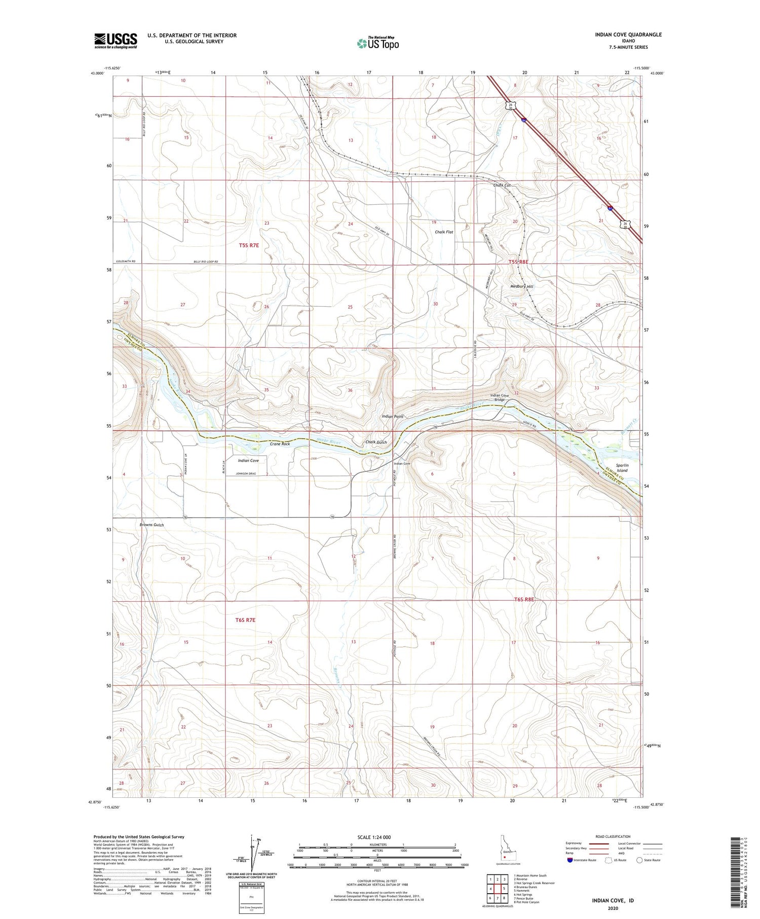
2023 topographic map quadrangle Indian Cove in the state of Idaho. Scale: 1:24000. Based on the newly updated USGS 7.5' US Topo map series, this map is in the following counties: Owyhee, Elmore. The map contains contour data, water features, and other items you are used to seeing on USGS maps, but also has updated roads and other features. This is the next generation of topographic maps. Printed on high-quality waterproof paper with UV fade-resistant inks.
Quads adjacent to this one:
West: Bruneau Dunes
Northwest: Mountain Home South
North: Reverse
Northeast: Hot Springs Creek Reservoir
East: Hammett
Southeast: Pot Hole Canyon
South: Pence Butte
Southwest: Hot Springs
This map covers the same area as the classic USGS quad with code o42115h5.
Contains the following named places: Bennett Creek, Browns Creek, Browns Gulch, Chalk Cut, Chalk Flat, Chalk Gulch, Chalk Spur, Commerford Springs, Crane Rock, Dry Creek, East Fork Browns Creek, Indian Cove, Indian Cove Bridge, Indian Point, Medbury Hill, ZIP Code: 83627