MyTopo
Bruneau Dunes Idaho US Topo Map
Couldn't load pickup availability
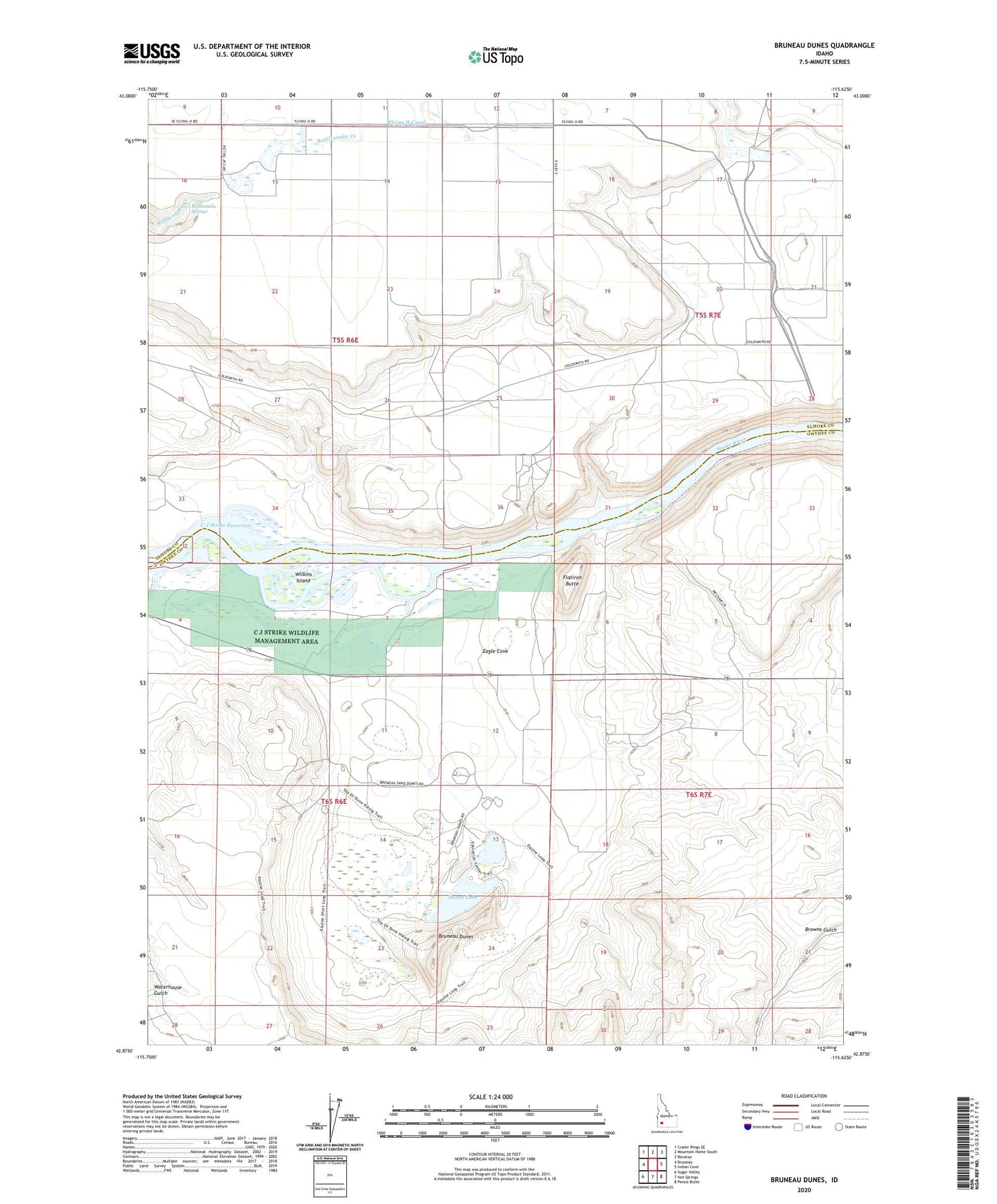
2023 topographic map quadrangle Bruneau Dunes in the state of Idaho. Scale: 1:24000. Based on the newly updated USGS 7.5' US Topo map series, this map is in the following counties: Owyhee, Elmore. The map contains contour data, water features, and other items you are used to seeing on USGS maps, but also has updated roads and other features. This is the next generation of topographic maps. Printed on high-quality waterproof paper with UV fade-resistant inks.
Quads adjacent to this one:
West: Bruneau
Northwest: Crater Rings SE
North: Mountain Home South
Northeast: Reverse
East: Indian Cove
Southeast: Pence Butte
South: Hot Springs
Southwest: Sugar Valley
This map covers the same area as the classic USGS quad with code o42115h6.
Contains the following named places: Barber Cabin, Blacks Island, Bruneau Duck Ponds, Bruneau Dunes, Bruneau Dunes State Park, C J Strike Wildlife Management Area, Dunes Lake, Eagle Cove, Flatiron Butte, Flying H Canal, Rattlesnake Springs, Snake River Birds of Prey Area, Watson Dam, Wilkins Island