MyTopo
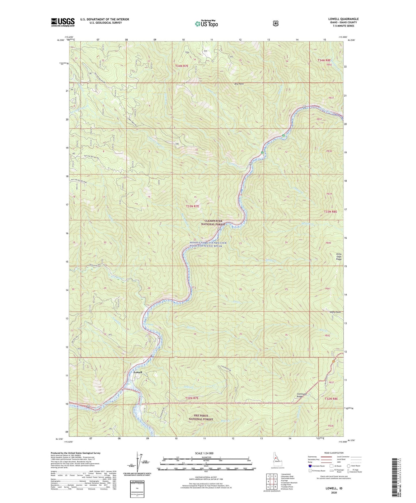
Lowell Idaho US Topo Map
Couldn't load pickup availability
Also explore the Lowell Forest Service Topo of this same quad for updated USFS data
2024 topographic map quadrangle Lowell in the state of Idaho. Scale: 1:24000. Based on the newly updated USGS 7.5' US Topo map series, this map is in the following counties: Idaho. The map contains contour data, water features, and other items you are used to seeing on USGS maps, but also has updated roads and other features. This is the next generation of topographic maps. Printed on high-quality waterproof paper with UV fade-resistant inks.
Quads adjacent to this one:
West: Syringa
Northwest: Musselshell
North: Boundary Peak
Northeast: McLendon Butte
East: Coolwater Mountain
Southeast: Stillman Point
South: Goddard Point
Southwest: Lodge Point
This map covers the same area as the classic USGS quad with code o46115b5.
Contains the following named places: Apgar Campground, Apgar Creek, Cabin Creek, Canyon Creek, Cat Creek, Chance Creek, Chitwood Mine, Deadman Creek, Dry Point, Glade Creek, Glade Creek Campground, Handy Creek, Hellgate Creek, Icicle Spring, Idaho Point, Kerr Creek, Knife Edge Ridge, Lochsa River, Lottie Creek, Lowell, Lowell Creek, Nut Creek, Pete King Creek, Rye Patch Creek, Selway River, South Fork Canyon Creek