MyTopo
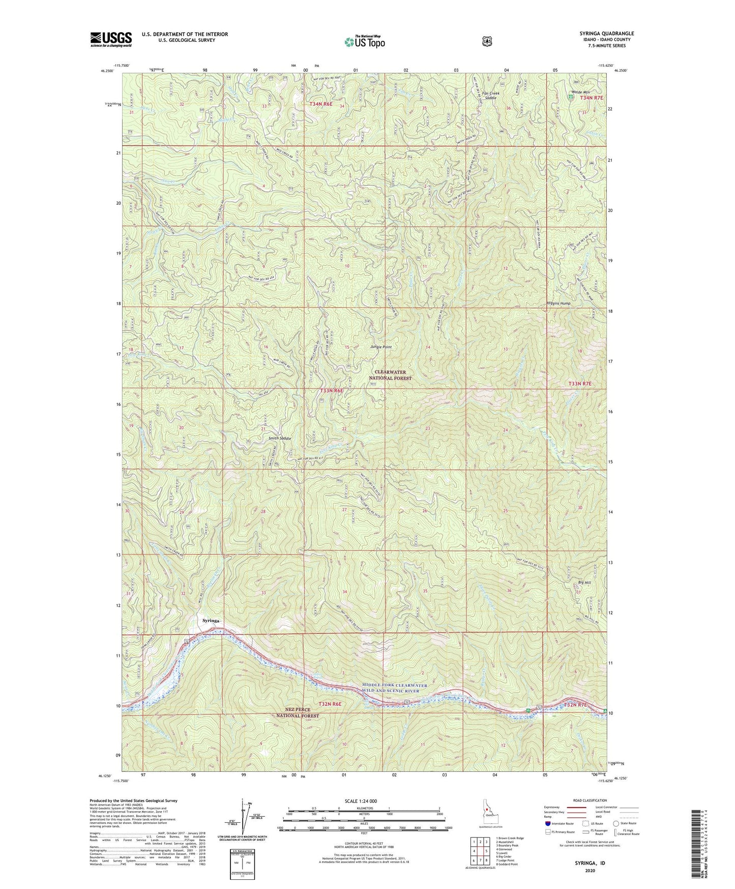
Syringa Idaho US Topo Map
Couldn't load pickup availability
Also explore the Syringa Forest Service Topo of this same quad for updated USFS data
2024 topographic map quadrangle Syringa in the state of Idaho. Scale: 1:24000. Based on the newly updated USGS 7.5' US Topo map series, this map is in the following counties: Idaho. The map contains contour data, water features, and other items you are used to seeing on USGS maps, but also has updated roads and other features. This is the next generation of topographic maps. Printed on high-quality waterproof paper with UV fade-resistant inks.
Quads adjacent to this one:
West: Glenwood
Northwest: Brown Creek Ridge
North: Musselshell
Northeast: Boundary Peak
East: Lowell
Southeast: Goddard Point
South: Lodge Point
Southwest: Big Cedar
This map covers the same area as the classic USGS quad with code o46115b6.
Contains the following named places: Big Hill, Big Hill Rapids, Big Smith Creek, Bridge Creek, Decker Creek, Fan Creek Saddle, Higgins Creek, Higgins Hump, Indian Rapids, Jungle Point, Little Smith Creek, Lodge Creek, Nan Creek, Number One Creek, Placer Creek, Polar Creek, Rat Creek, Smith Creek Work Center, Smith Mine, Smith Saddle, Stray Creek, Swan Creek, Syringa, Three Devils Creek, Three Devils Picnic Area, Walde Creek, Walde Mountain, Wild Goose Campground