MyTopo
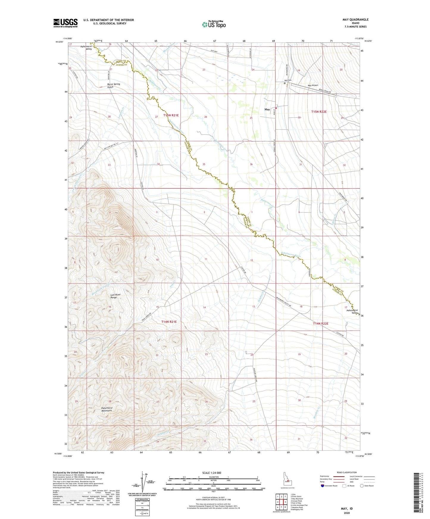
May Idaho US Topo Map
Couldn't load pickup availability
Also explore the May Forest Service Topo of this same quad for updated USFS data
2023 topographic map quadrangle May in the state of Idaho. Scale: 1:24000. Based on the newly updated USGS 7.5' US Topo map series, this map is in the following counties: Custer, Lemhi. The map contains contour data, water features, and other items you are used to seeing on USGS maps, but also has updated roads and other features. This is the next generation of topographic maps. Printed on high-quality waterproof paper with UV fade-resistant inks.
Quads adjacent to this one:
West: Grouse Peak
Northwest: Ellis
North: Ennis Gulch
Northeast: May Mountain
East: East of May
Southeast: Mahogany Hill
South: Meadow Peak
Southwest: Little Antelope Flat
This map covers the same area as the classic USGS quad with code o44113e8.
Contains the following named places: Blind Fork Trail Creek, Burnt Spring Gulch, Falls Creek, John Short Springs, Lawson Creek, May, May Airport, May Cemetery, Meadow Creek, Morgan Creek, Morse Creek, North Fork Lawson Creek, Pahsimeroi Hatchery, Pahsimeroi Volunteer Fire Department, Patterson Creek, South Fork Lawson Creek, Sulphur Creek, Trail Creek