MyTopo
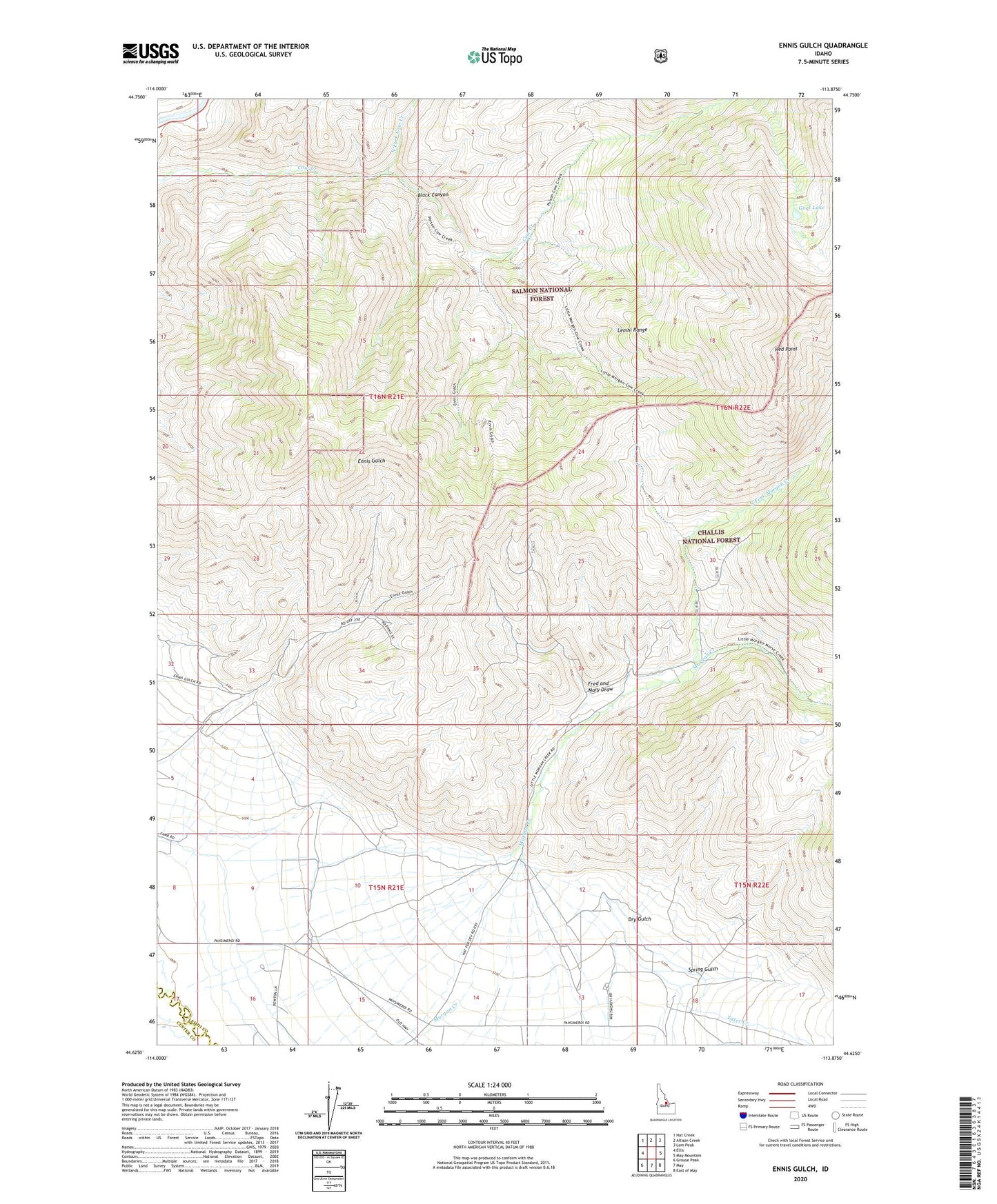
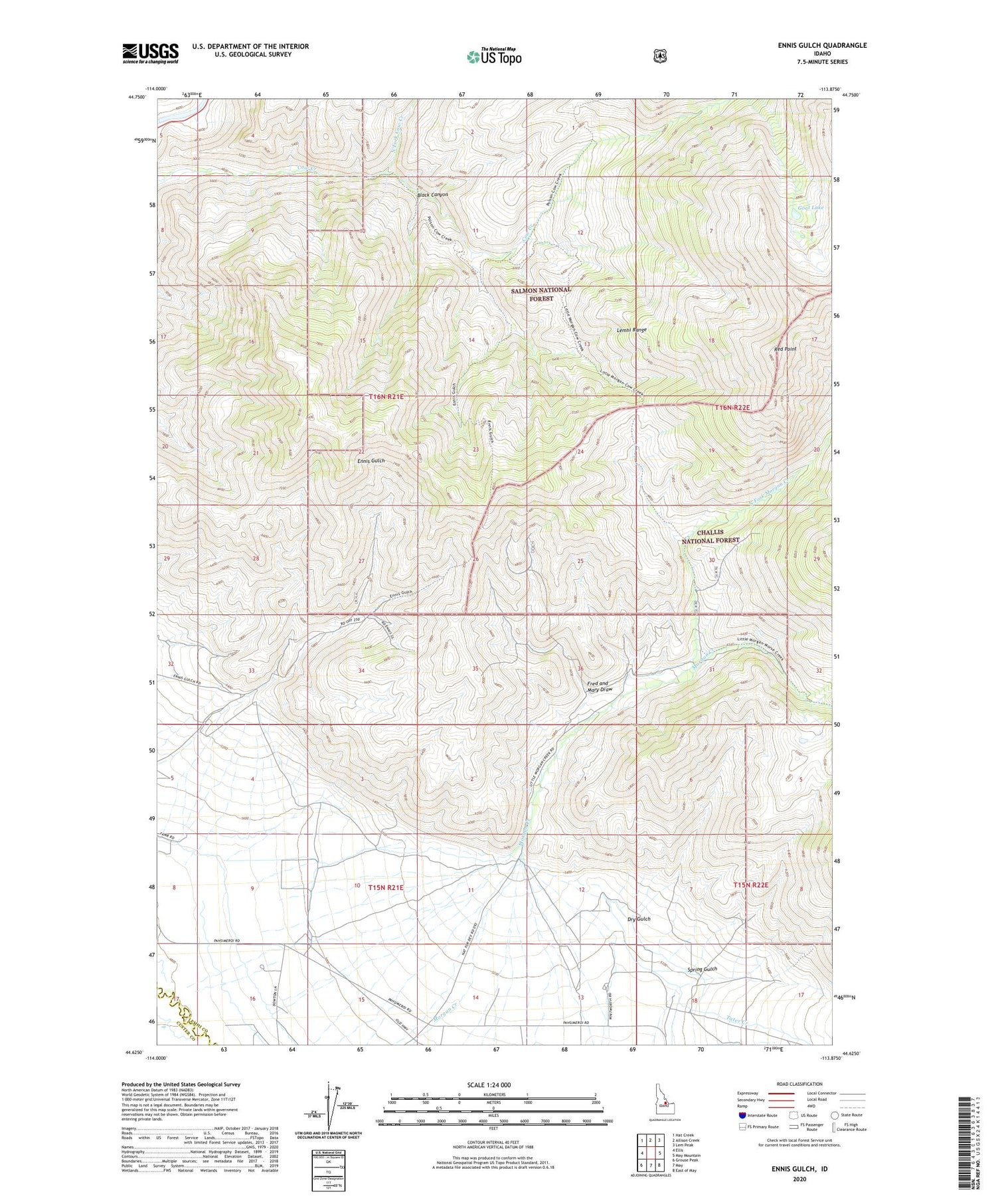
Ennis Gulch Idaho US Topo Map
Couldn't load pickup availability
Also explore the Ennis Gulch Forest Service Topo of this same quad for updated USFS data
2024 topographic map quadrangle Ennis Gulch in the state of Idaho. Scale: 1:24000. Based on the newly updated USGS 7.5' US Topo map series, this map is in the following counties: Lemhi, Custer. The map contains contour data, water features, and other items you are used to seeing on USGS maps, but also has updated roads and other features. This is the next generation of topographic maps. Printed on high-quality waterproof paper with UV fade-resistant inks.
Quads adjacent to this one:
West: Ellis
Northwest: Hat Creek
North: Allison Creek
Northeast: Lem Peak
East: May Mountain
Southeast: East of May
South: May
Southwest: Grouse Peak
This map covers the same area as the classic USGS quad with code o44113f8.
Contains the following named places: Black Canyon, Dry Gulch, East Fork Morgan Creek, Fred and Mary Draw, Goat Lake, North Fork Cow Creek, North Fork Morgan Creek, Patterson Division, Red Point, Spring Gulch, Tater Creek