MyTopo
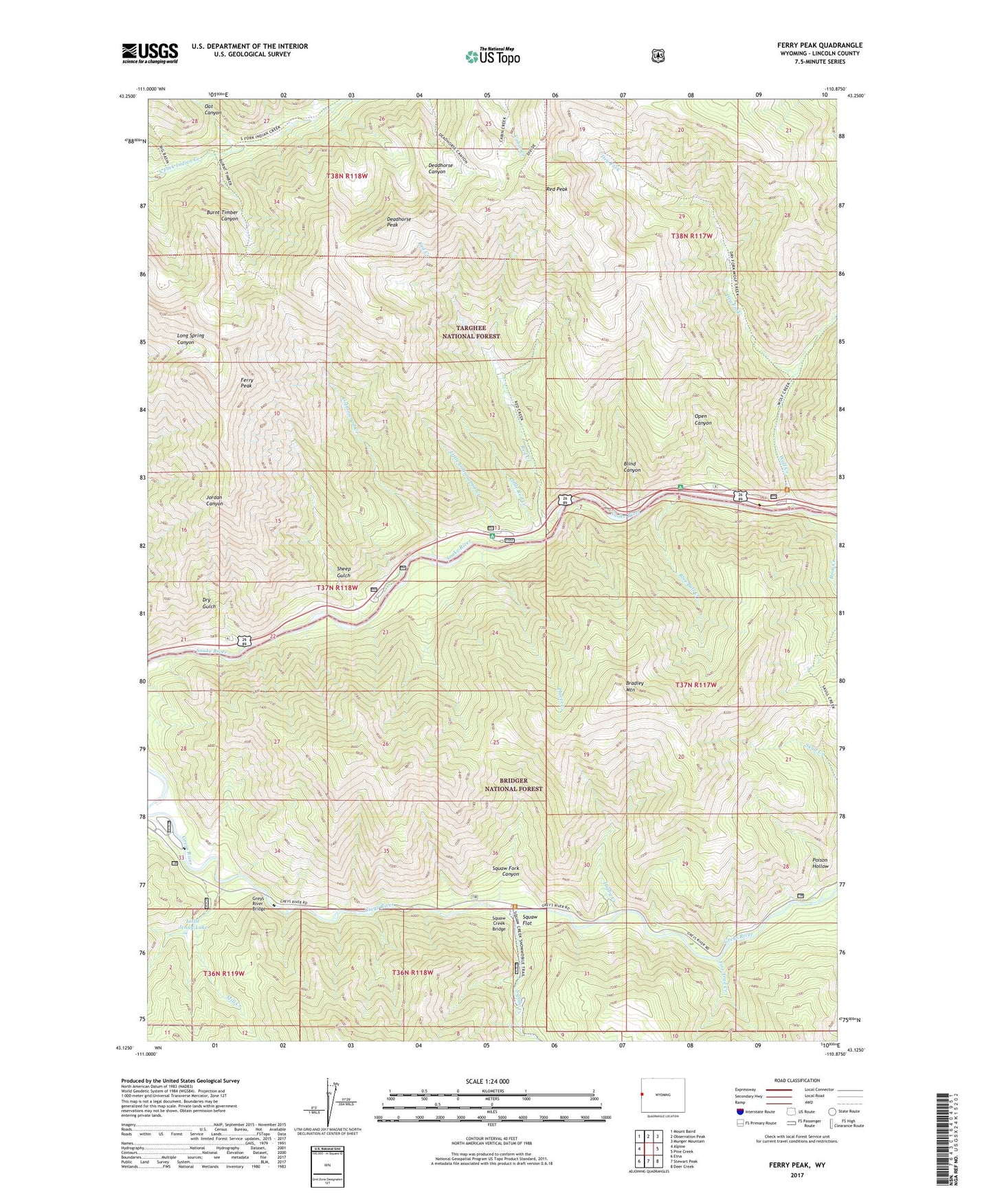
Ferry Peak Wyoming US Topo Map
Couldn't load pickup availability
Also explore the Ferry Peak Forest Service Topo of this same quad for updated USFS data
2023 topographic map quadrangle Ferry Peak in the state of Wyoming. Scale: 1:24000. Based on the newly updated USGS 7.5' US Topo map series, this map is in the following counties: Lincoln. The map contains contour data, water features, and other items you are used to seeing on USGS maps, but also has updated roads and other features. This is the next generation of topographic maps. Printed on high-quality waterproof paper with UV fade-resistant inks.
Quads adjacent to this one:
West: Alpine
Northwest: Mount Baird
North: Observation Peak
Northeast: Munger Mountain
East: Pine Creek
Southeast: Deer Creek
South: Stewart Peak
Southwest: Etna
This map covers the same area as the classic USGS quad with code o43110b8.
Contains the following named places: Blind Canyon, Blue Bell Creek, Bradley Mountain, Bridge Campground, Burnt Timber Canyon, Cottonwood Creek, Deadhorse Peak, Dry Fork, Dry Gulch, Ferry Peak, Fire Trail Creek, Forks Campground, Grand Canyon, Greys River Bridge, Higby Creek, Little Cottonwood Creek, Little Jenny Lake, Little Red Creek, Mill Creek, Oat Canyon, Open Canyon, Placer Creek, Poison Hollow, Red Creek, Red Peak, Sheep Gulch, Sheep Gulch Boat Ramp, Squaw Creek, Squaw Creek Bridge, Squaw Flat, Squaw Fork Canyon, Wolf Creek, Wolf Creek Campground