MyTopo
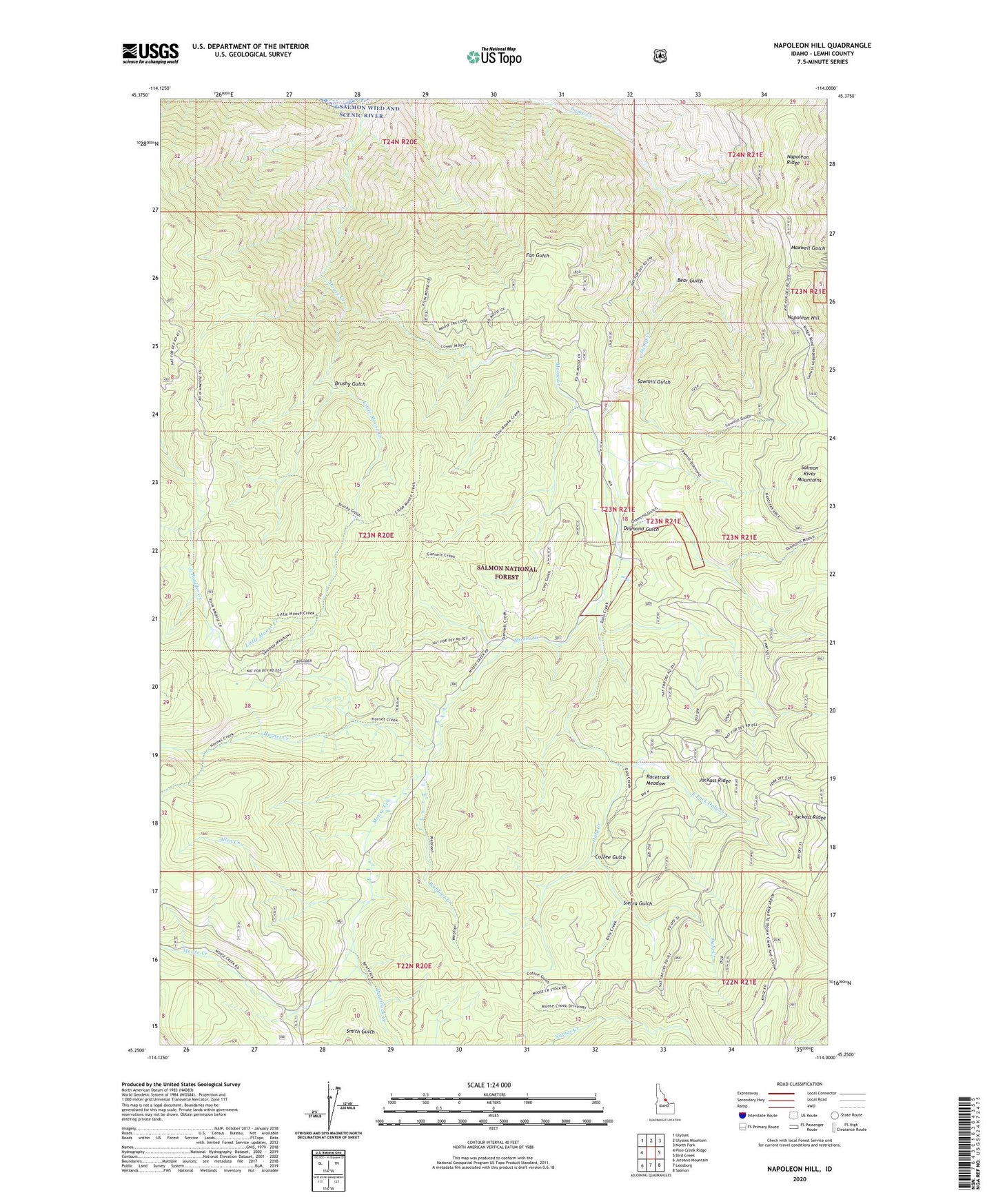
Napoleon Hill Idaho US Topo Map
Couldn't load pickup availability
Also explore the Napoleon Hill Forest Service Topo of this same quad for updated USFS data
2024 topographic map quadrangle Napoleon Hill in the state of Idaho. Scale: 1:24000. Based on the newly updated USGS 7.5' US Topo map series, this map is in the following counties: Lemhi. The map contains contour data, water features, and other items you are used to seeing on USGS maps, but also has updated roads and other features. This is the next generation of topographic maps. Printed on high-quality waterproof paper with UV fade-resistant inks.
Quads adjacent to this one:
West: Pine Creek Ridge
Northwest: Ulysses
North: Ulysses Mountain
Northeast: North Fork
East: Bird Creek
Southeast: Salmon
South: Leesburg
Southwest: Jureano Mountain
This map covers the same area as the classic USGS quad with code o45114c1.
Contains the following named places: Allen Creek, Bear Gulch, Beartrack Creek, Big Boulder Meadow, Brushy Gulch, Brushy Gulch Trail, Coffee Gulch, Daly Creek, Daly Creek Trail, Diamond Gulch, East Fork Daly Creek, Hornet Creek, Hornet Creek Trail, Jackass Ridge, Little Moose Creek, Moose Creek, Moose Creek Trail, Napoleon Hill, Napoleon Ridge, Racetrack Meadow, Sawmill Gulch, Sierra Gulch, Webfoot Creek