MyTopo
North Fork Idaho US Topo Map
Couldn't load pickup availability
Also explore the North Fork Forest Service Topo of this same quad for updated USFS data
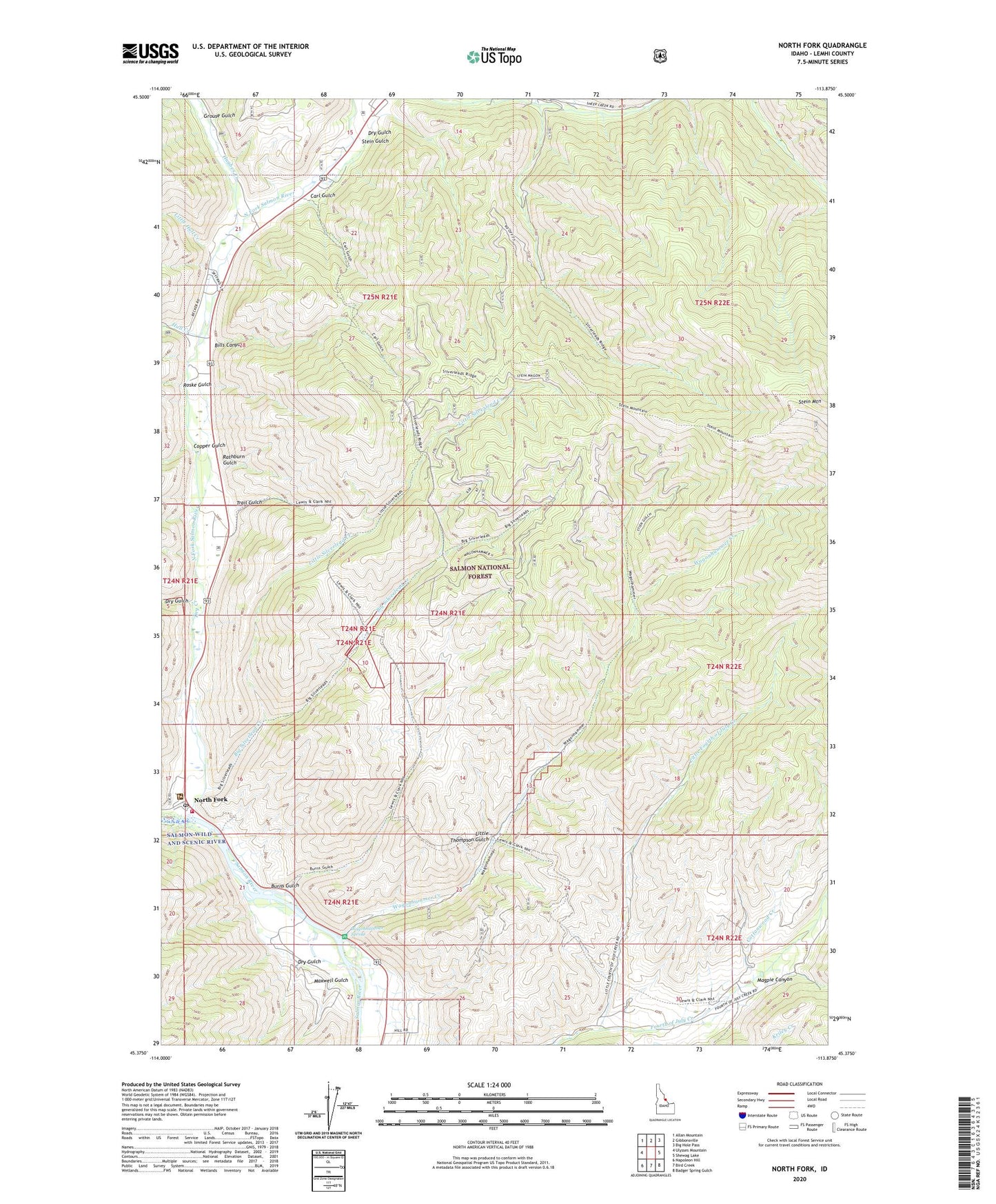
2024 topographic map quadrangle North Fork in the state of Idaho. Scale: 1:24000. Based on the newly updated USGS 7.5' US Topo map series, this map is in the following counties: Lemhi. The map contains contour data, water features, and other items you are used to seeing on USGS maps, but also has updated roads and other features. This is the next generation of topographic maps. Printed on high-quality waterproof paper with UV fade-resistant inks.
Quads adjacent to this one:
West: Ulysses Mountain
Northwest: Allan Mountain
North: Gibbonsville
Northeast: Big Hole Pass
East: Shewag Lake
Southeast: Badger Spring Gulch
South: Bird Creek
Southwest: Napoleon Hill
This map covers the same area as the classic USGS quad with code o45113d8.
Contains the following named places: Big Silverlead Creek, Bills Canyon, Burns Gulch, Carl Gulch, Cassel Gulch, Copper Gulch, Cottonwood Creek, Cumming Triangle Landing Area, Dry Creek, Dry Gulch, Grouse Gulch, Hughes Creek, Hull Creek, Lewis and Clark Monument, Little Fourth of July Creek, Little Hull Creek, Little Silverlead Creek, Little Thompson Gulch, Magpie Canyon, Maxwell Gulch, North Fork, North Fork Fire District, North Fork Post Office, North Fork Ranger Station, North Fork Salmon River, Rathburn Gulch, Roske Gulch, Sheep Creek, Stein Gulch, Stein Mountain, Trail Gulch, Wagonhammer Campground, Wagonhammer Creek, Wagonhammer Spring