MyTopo
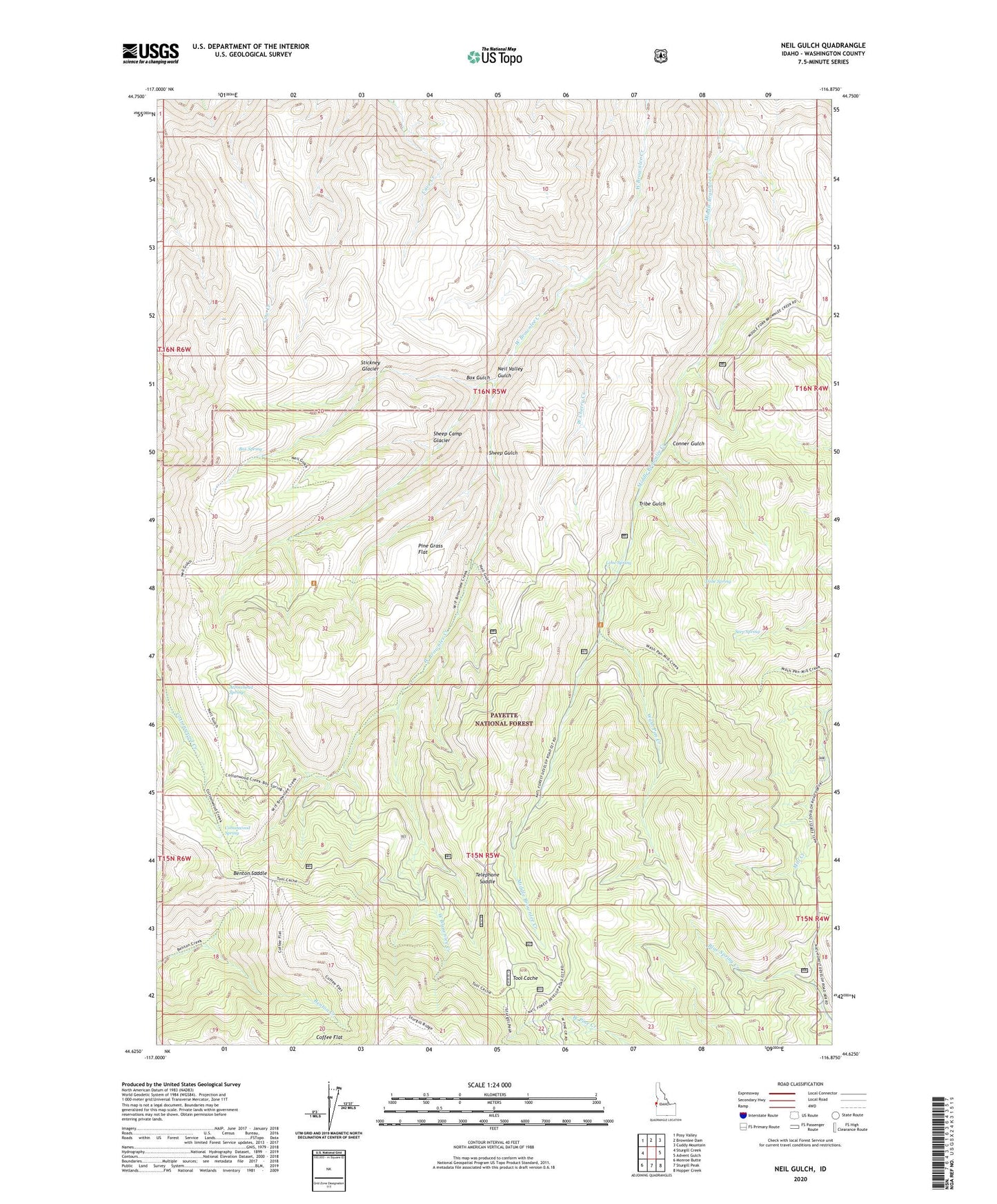
Neil Gulch Idaho US Topo Map
Couldn't load pickup availability
Also explore the Neil Gulch Forest Service Topo of this same quad for updated USFS data
2024 topographic map quadrangle Neil Gulch in the state of Idaho. Scale: 1:24000. Based on the newly updated USGS 7.5' US Topo map series, this map is in the following counties: Washington. The map contains contour data, water features, and other items you are used to seeing on USGS maps, but also has updated roads and other features. This is the next generation of topographic maps. Printed on high-quality waterproof paper with UV fade-resistant inks.
Quads adjacent to this one:
West: Sturgill Creek
Northwest: Posy Valley
North: Brownlee Dam
Northeast: Cuddy Mountain
East: Advent Gulch
Southeast: Hopper Creek
South: Sturgill Peak
Southwest: Monroe Butte
This map covers the same area as the classic USGS quad with code o44116f8.
Contains the following named places: Arrowhead Spring, Benton Saddle, Box Gulch, Box Spring, Conner Gulch, Cottonwood Spring, Hit Mountain Ski Area, Hitt Mountain Ski Area, Lime Spring, Neil Valley Gulch, Pine Grass Flat, Seep Spring, Sheep Camp Gulch, Sheep Gulch, Stickney Gulch, Telephone Saddle, Tool Cache, Tribe Gulch, Tribe Spring, Wash Pan Creek, West Cherry Creek