
MyTopo
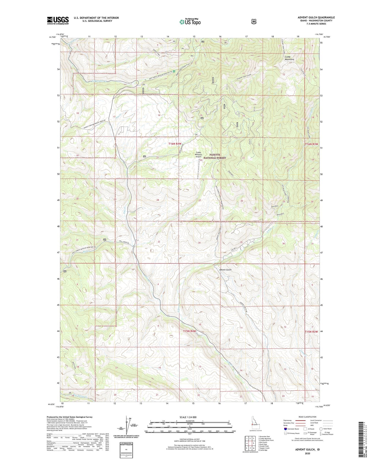
Advent Gulch Idaho US Topo Map
Couldn't load pickup availability
Also explore the Advent Gulch Forest Service Topo of this same quad for updated USFS data
2024 topographic map quadrangle Advent Gulch in the state of Idaho. Scale: 1:24000. Based on the newly updated USGS 7.5' US Topo map series, this map is in the following counties: Washington. The map contains contour data, water features, and other items you are used to seeing on USGS maps, but also has updated roads and other features. This is the next generation of topographic maps. Printed on high-quality waterproof paper with UV fade-resistant inks.
Quads adjacent to this one:
West: Neil Gulch
Northwest: Brownlee Dam
North: Cuddy Mountain
Northeast: Crooked River Point
East: Rush Peak
Southeast: Cambridge
South: Hopper Creek
Southwest: Sturgill Peak
This map covers the same area as the classic USGS quad with code o44116f7.
Contains the following named places: Brownlee Ranger Station, Cambridge Division, Camp Creek, Cuddy Meadows Airport, East Pine Creek, Mill Creek, Repeater Station, ZIP Code: 83610


