MyTopo
Peck Idaho US Topo Map
Couldn't load pickup availability
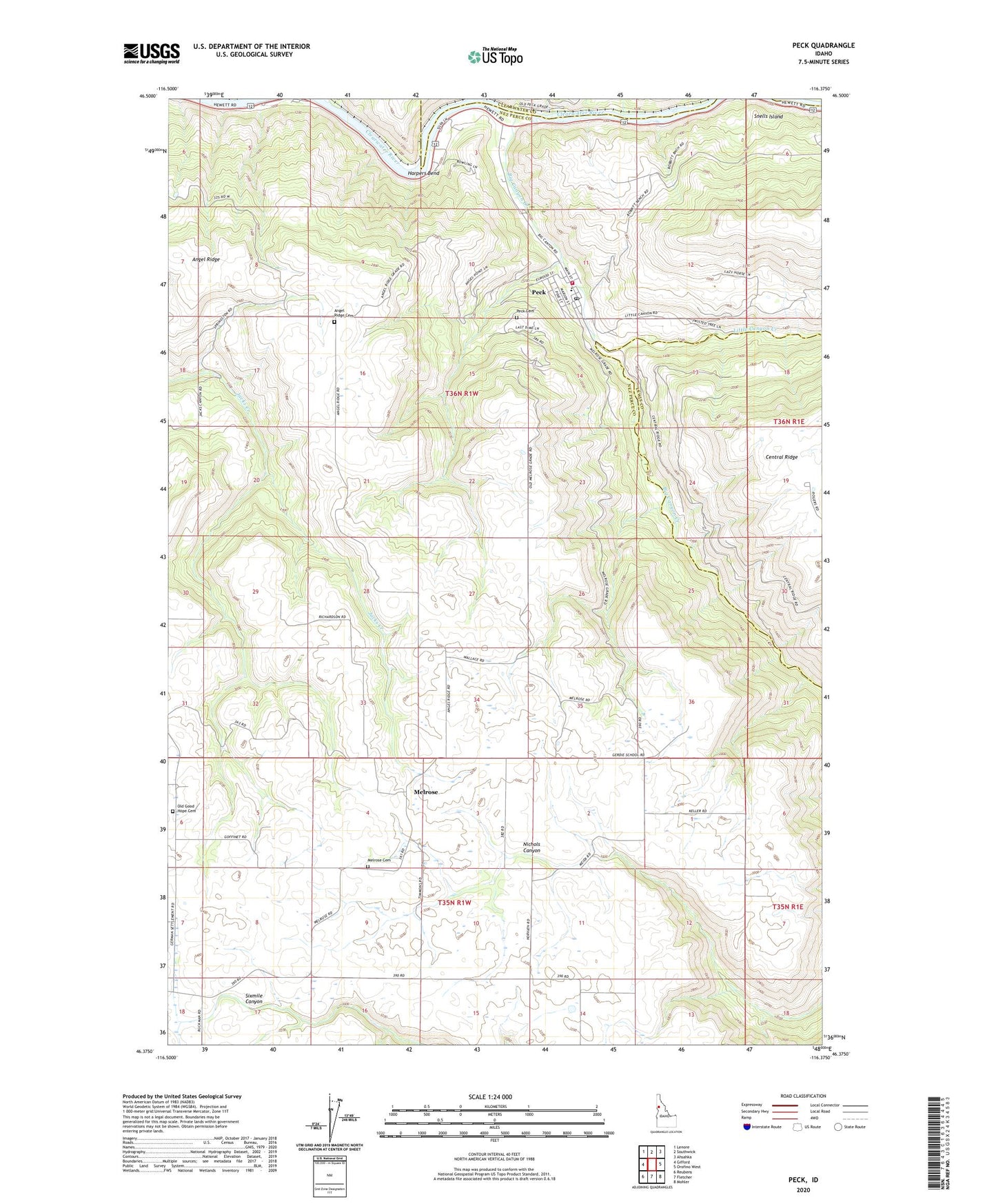
2024 topographic map quadrangle Peck in the state of Idaho. Scale: 1:24000. Based on the newly updated USGS 7.5' US Topo map series, this map is in the following counties: Nez Perce, Lewis, Clearwater. The map contains contour data, water features, and other items you are used to seeing on USGS maps, but also has updated roads and other features. This is the next generation of topographic maps. Printed on high-quality waterproof paper with UV fade-resistant inks.
Quads adjacent to this one:
West: Gifford
Northwest: Lenore
North: Southwick
Northeast: Ahsahka
East: Orofino West
Southeast: Mohler
South: Fletcher
Southwest: Reubens
This map covers the same area as the classic USGS quad with code o46116d4.
Contains the following named places: Angel Ridge, Angel Ridge Cemetery, Big Canyon Creek, Big Canyon Fire District, City of Peck, Good Hope Church, Harpers Bend, Little Canyon Creek, Melrose, Melrose Cemetery, Old Good Hope Cemetery, Peck, Peck Access Area, Peck Cemetery, Peck Elementary School, Peck Post Office, Snells Island, Thompson Dam, ZIP Code: 83545