MyTopo
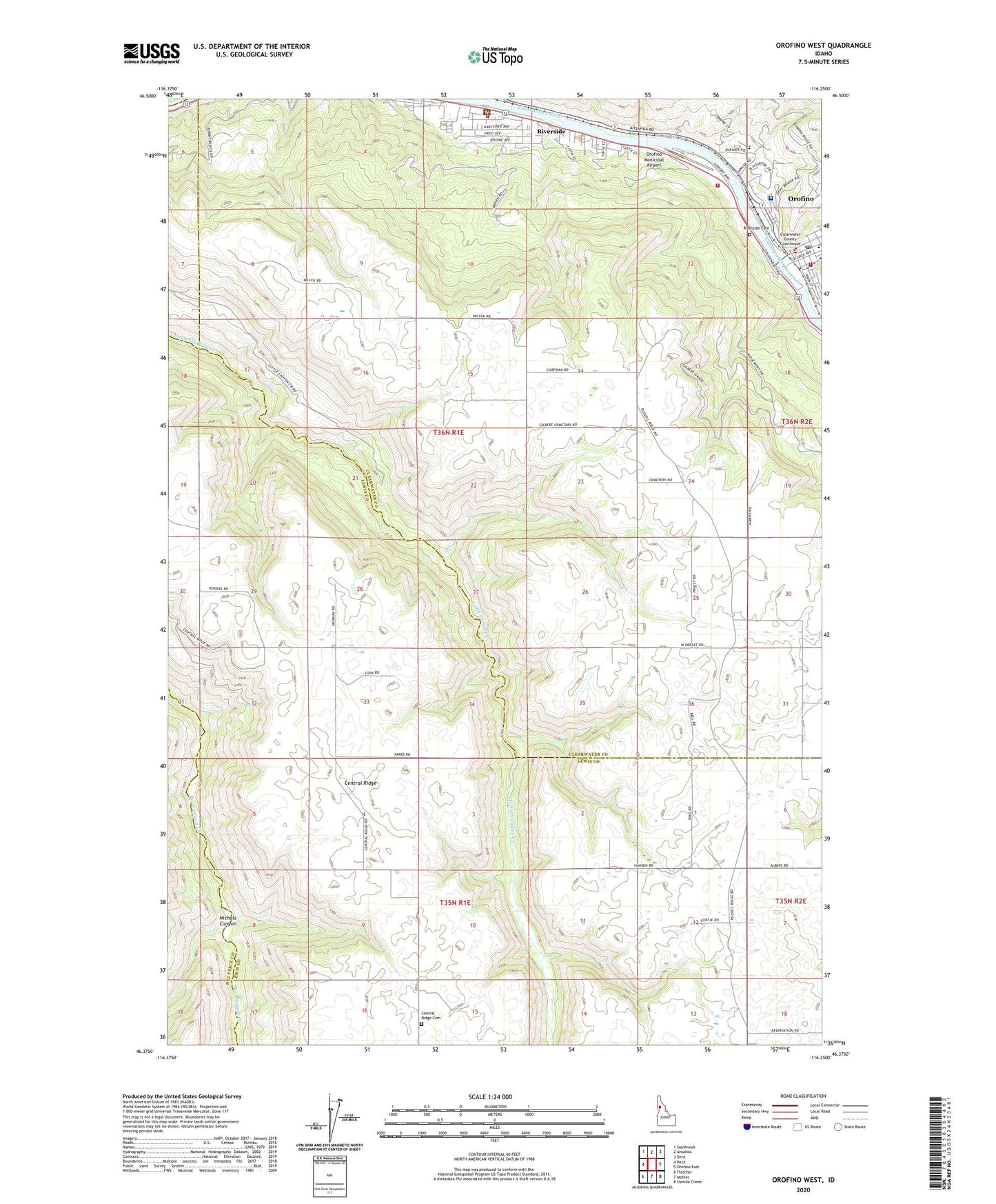
Orofino West Idaho US Topo Map
Couldn't load pickup availability
Also explore the Orofino West Forest Service Topo of this same quad for updated USFS data
2024 topographic map quadrangle Orofino West in the state of Idaho. Scale: 1:24000. Based on the newly updated USGS 7.5' US Topo map series, this map is in the following counties: Clearwater, Lewis, Nez Perce. The map contains contour data, water features, and other items you are used to seeing on USGS maps, but also has updated roads and other features. This is the next generation of topographic maps. Printed on high-quality waterproof paper with UV fade-resistant inks.
Quads adjacent to this one:
West: Peck
Northwest: Southwick
North: Ahsahka
Northeast: Dent
East: Orofino East
Southeast: Sixmile Creek
South: Mohler
Southwest: Fletcher
This map covers the same area as the classic USGS quad with code o46116d3.
Contains the following named places: Canyon and Kelly Creek Ranger Station, Central Ridge, Central Ridge Cemetery, City of Orofino, Clearwater County Ambulance, Clearwater County Sheriff's Office, Clearwater Potlatch Timber Protective Association, Clearwater Valley Hospital, Gilbert Church, Idaho Correctional Institution - Orofino, Lewis-Clark Canoe Camp State Park, Nez Perce Division, Nichols Canyon, North Fork Clearwater River, Orofino, Orofino Creek, Orofino Fire Department Station 1, Orofino Fire Department Station 2, Orofino High School, Orofino Junior High School, Orofino Municipal Airport, Orofino Police Department, Orofino Post Office, Riverside, Riverside Cemetery, Russell, State Hospital North