MyTopo
Poison Butte Idaho US Topo Map
Couldn't load pickup availability
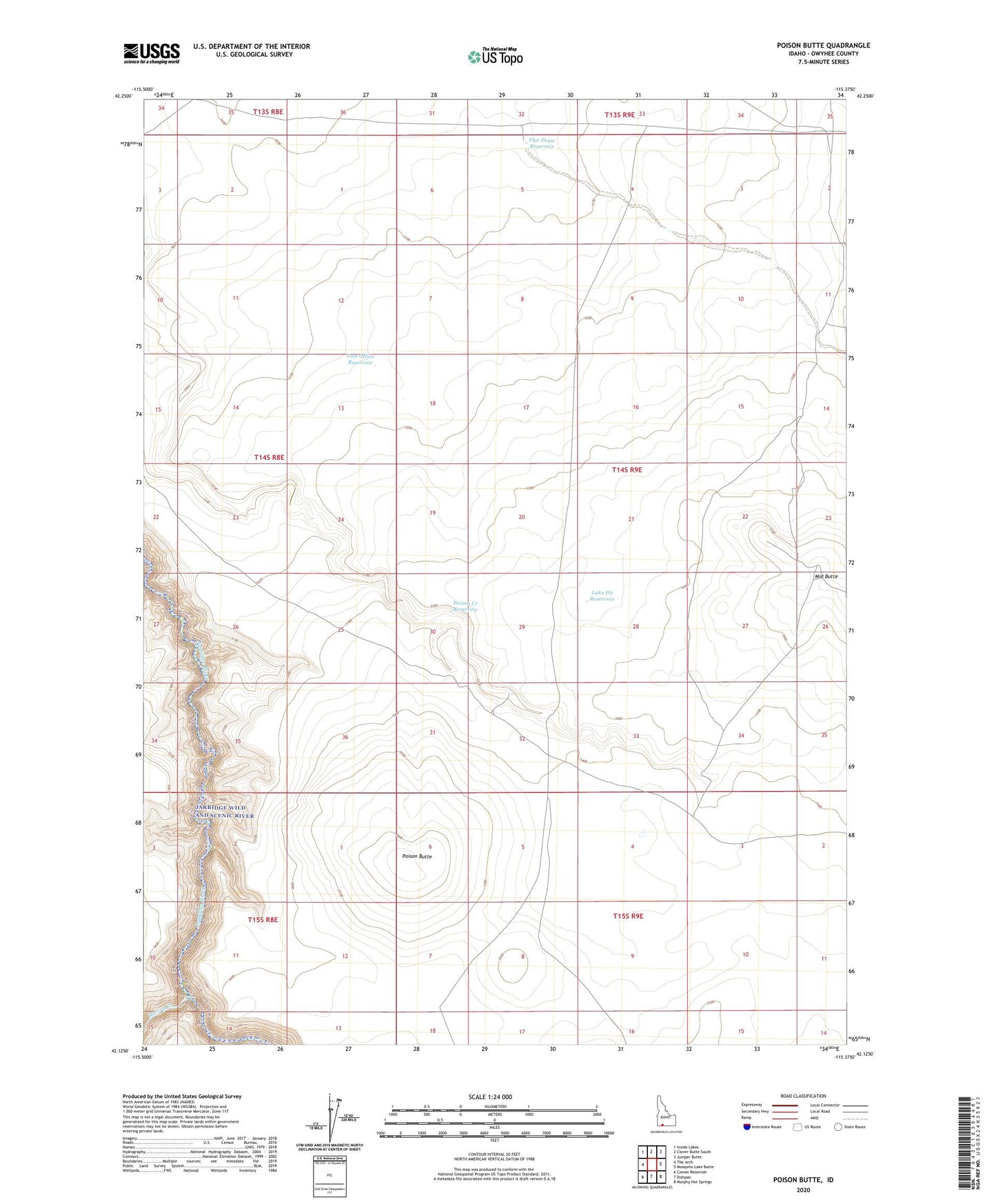
2023 topographic map quadrangle Poison Butte in the state of Idaho. Scale: 1:24000. Based on the newly updated USGS 7.5' US Topo map series, this map is in the following counties: Owyhee. The map contains contour data, water features, and other items you are used to seeing on USGS maps, but also has updated roads and other features. This is the next generation of topographic maps. Printed on high-quality waterproof paper with UV fade-resistant inks.
Quads adjacent to this one:
West: The Arch
Northwest: Inside Lakes
North: Clover Butte South
Northeast: Juniper Butte
East: Mosquito Lake Butte
Southeast: Murphy Hot Springs
South: Dishpan
Southwest: Cowan Reservoir
This map covers the same area as the classic USGS quad with code o42115b4.
Contains the following named places: Dorsey Creek, Flat Draw Reservoir, Lake Pit Reservoir, Poison Butte, Poison Creek Reservoir, Post Office Crossing, Post Office Reservoir, Three Creek Well