MyTopo
Murphy Hot Springs Idaho US Topo Map
Couldn't load pickup availability
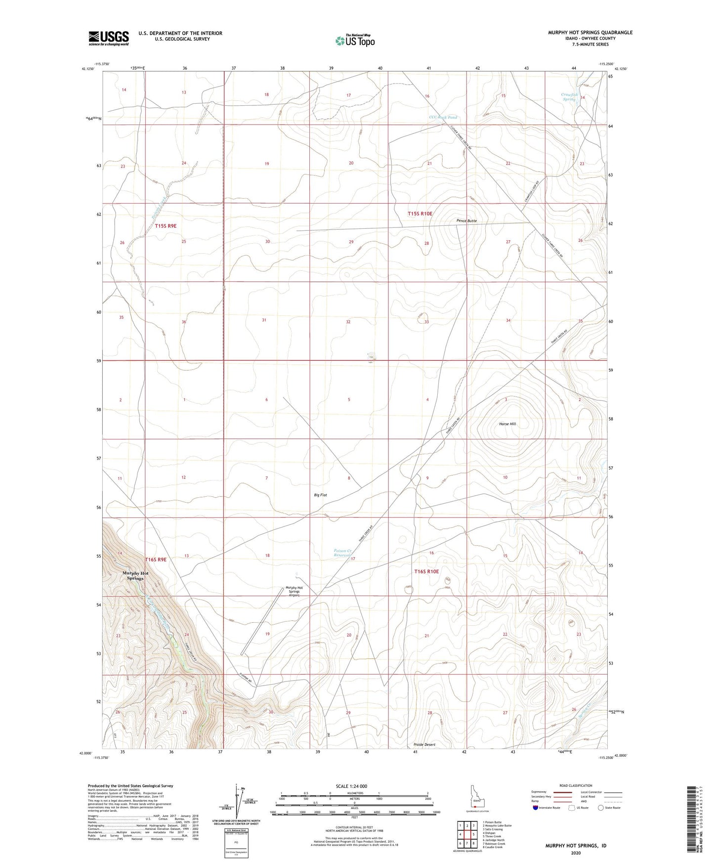
2023 topographic map quadrangle Murphy Hot Springs in the state of Idaho. Scale: 1:24000. Based on the newly updated USGS 7.5' US Topo map series, this map is in the following counties: Owyhee. The map contains contour data, water features, and other items you are used to seeing on USGS maps, but also has updated roads and other features. This is the next generation of topographic maps. Printed on high-quality waterproof paper with UV fade-resistant inks.
Quads adjacent to this one:
West: Dishpan
Northwest: Poison Butte
North: Mosquito Lake Butte
Northeast: Salls Crossing
East: Three Creek
Southeast: Caudle Creek
South: Robinson Creek
Southwest: Jarbidge North
This map covers the same area as the classic USGS quad with code o42115a3.
Contains the following named places: Big Flat, CCC Rock Pond, Crawfish Spring, Horse Hill, Horse Lake, Jim Bob Reservoir, Murphy Hot Springs, Murphy Hot Springs Airport, Pence Butte, Poison Creek Reservoir