MyTopo
Pot Mountain Idaho US Topo Map
Couldn't load pickup availability
Also explore the Pot Mountain Forest Service Topo of this same quad for updated USFS data
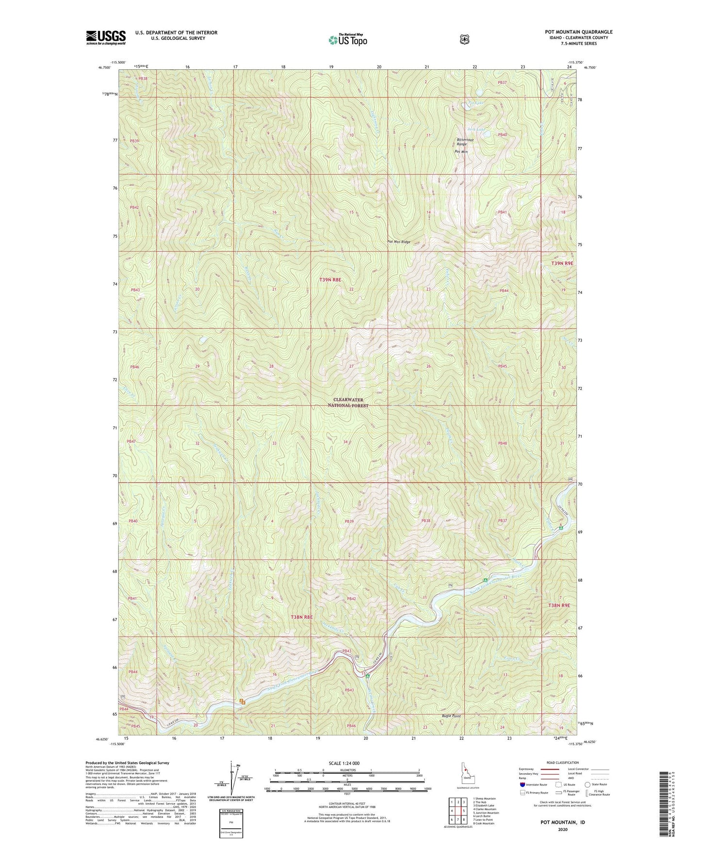
2024 topographic map quadrangle Pot Mountain in the state of Idaho. Scale: 1:24000. Based on the newly updated USGS 7.5' US Topo map series, this map is in the following counties: Clearwater. The map contains contour data, water features, and other items you are used to seeing on USGS maps, but also has updated roads and other features. This is the next generation of topographic maps. Printed on high-quality waterproof paper with UV fade-resistant inks.
Quads adjacent to this one:
West: Clarke Mountain
Northwest: Sheep Mountain
North: The Nub
Northeast: Elizabeth Lake
East: Junction Mountain
Southeast: Cook Mountain
South: Lean-to Point
Southwest: Larch Butte
This map covers the same area as the classic USGS quad with code o46115f4.
Contains the following named places: Bitterroot Range, Bugle Point, Cub Creek, Death Creek, Elk Yard, Fawn Creek, Fisher Creek, Fourth of July Creek, Jack Lake, Jackknife Creek, Pierce-Headquarters Division, Pot Lake, Pot Mountain, Rush Creek, Sprague Creek, Sun Creek, Teakweh Creek, Weitas Creek