MyTopo
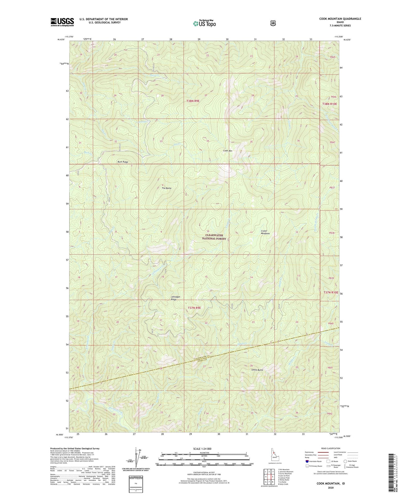
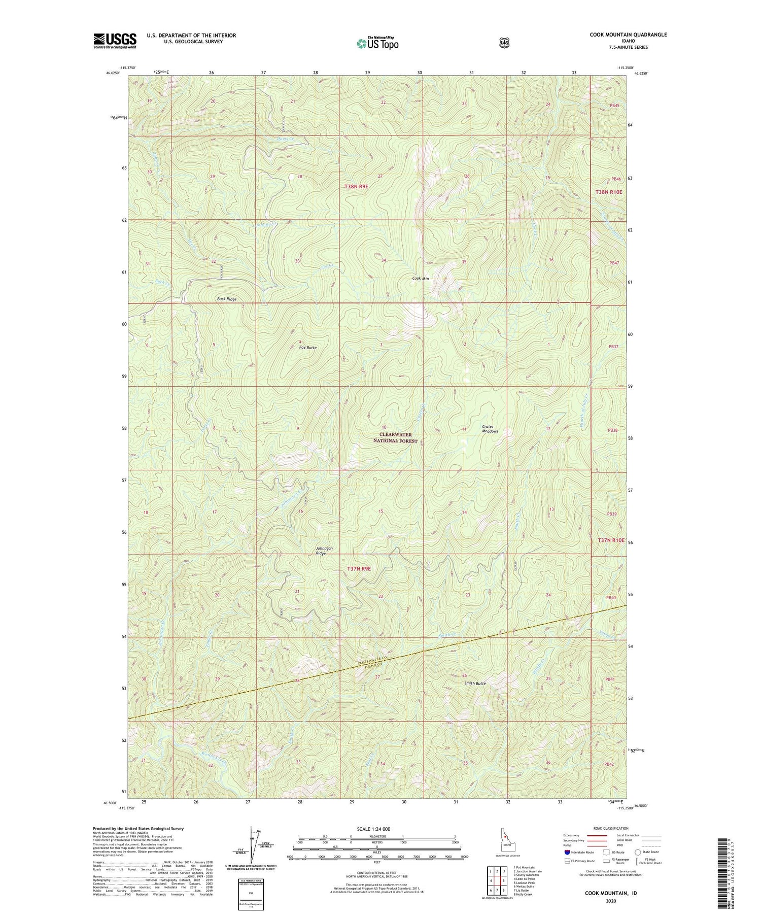
Cook Mountain Idaho US Topo Map
Couldn't load pickup availability
Also explore the Cook Mountain Forest Service Topo of this same quad for updated USFS data
2024 topographic map quadrangle Cook Mountain in the state of Idaho. Scale: 1:24000. Based on the newly updated USGS 7.5' US Topo map series, this map is in the following counties: Clearwater, Idaho. The map contains contour data, water features, and other items you are used to seeing on USGS maps, but also has updated roads and other features. This is the next generation of topographic maps. Printed on high-quality waterproof paper with UV fade-resistant inks.
Quads adjacent to this one:
West: Lean-to Point
Northwest: Pot Mountain
North: Junction Mountain
Northeast: Scurvy Mountain
East: Lookout Peak
Southeast: Holly Creek
South: Liz Butte
Southwest: Weitas Butte
This map covers the same area as the classic USGS quad with code o46115e3.
Contains the following named places: Buck Ridge, Cook Creek, Cook Mountain, Crater Creek, Crater Meadows, Davis Creek, Fox Butte, Fox Creek, Johnagan Creek, Johnagan Ridge, Magary Camp, Smith Butte, Smith Creek, Tinkle Creek, Young Creek