MyTopo
Register Rock Idaho US Topo Map
Couldn't load pickup availability
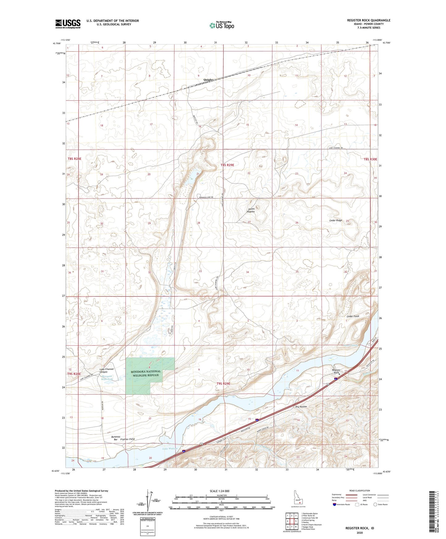
2023 topographic map quadrangle Register Rock in the state of Idaho. Scale: 1:24000. Based on the newly updated USGS 7.5' US Topo map series, this map is in the following counties: Power. The map contains contour data, water features, and other items you are used to seeing on USGS maps, but also has updated roads and other features. This is the next generation of topographic maps. Printed on high-quality waterproof paper with UV fade-resistant inks.
Quads adjacent to this one:
West: Gifford Spring
Northwest: Rattlesnake Butte
North: Pillar Butte SE
Northeast: American Falls SW
East: Neeley
Southeast: Rockland West
South: Badger Peak
Southwest: North Chapin Mountain
This map covers the same area as the classic USGS quad with code o42113f1.
Contains the following named places: Bonanza Lake, Cedar Field, Cedar Ridge, Dry Hollow, Fall Creek, Frymier Field, Janies Nipples, Lake Channel Canyon, Little Warm Creek, Morgans Waterhole, Mowers Spring, Quigley, Register Rock, Register Rock State Picnic Ground, Rock Creek, ZIP Code: 83211