MyTopo
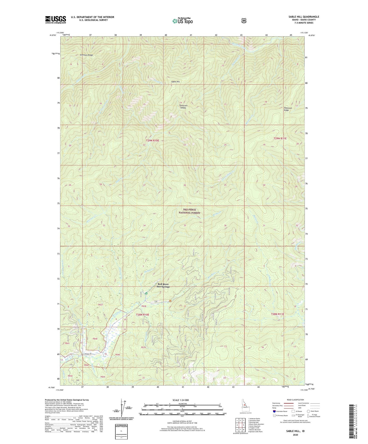
Sable Hill Idaho US Topo Map
Couldn't load pickup availability
Also explore the Sable Hill Forest Service Topo of this same quad for updated USFS data
2024 topographic map quadrangle Sable Hill in the state of Idaho. Scale: 1:24000. Based on the newly updated USGS 7.5' US Topo map series, this map is in the following counties: Idaho. The map contains contour data, water features, and other items you are used to seeing on USGS maps, but also has updated roads and other features. This is the next generation of topographic maps. Printed on high-quality waterproof paper with UV fade-resistant inks.
Quads adjacent to this one:
West: Black Hawk Mountain
Northwest: Anderson Butte
North: Vermilion Peak
Northeast: Running Lake
East: Green Mountain
Southeast: Spread Creek Point
South: Boston Mountain
Southwest: Trapper Creek
This map covers the same area as the classic USGS quad with code o45115g2.
Contains the following named places: Baston Creek, Biscuit Creek, Bridge Creek, Bridge Creek Campground, Butter Creek, East Fork Sable Creek, East Fork Trail Creek, Little Schwar Creek, Matteson Creek, Matteson Ridge, Otterson Creek, Red River Hot Springs, Red River Hot Springs Recreation Site, Sable Hill, Shissler Creek, Simmons Creek, Tamarack Creek, Tamarack Saddle, Trail Creek, West Fork Sable Creek