MyTopo
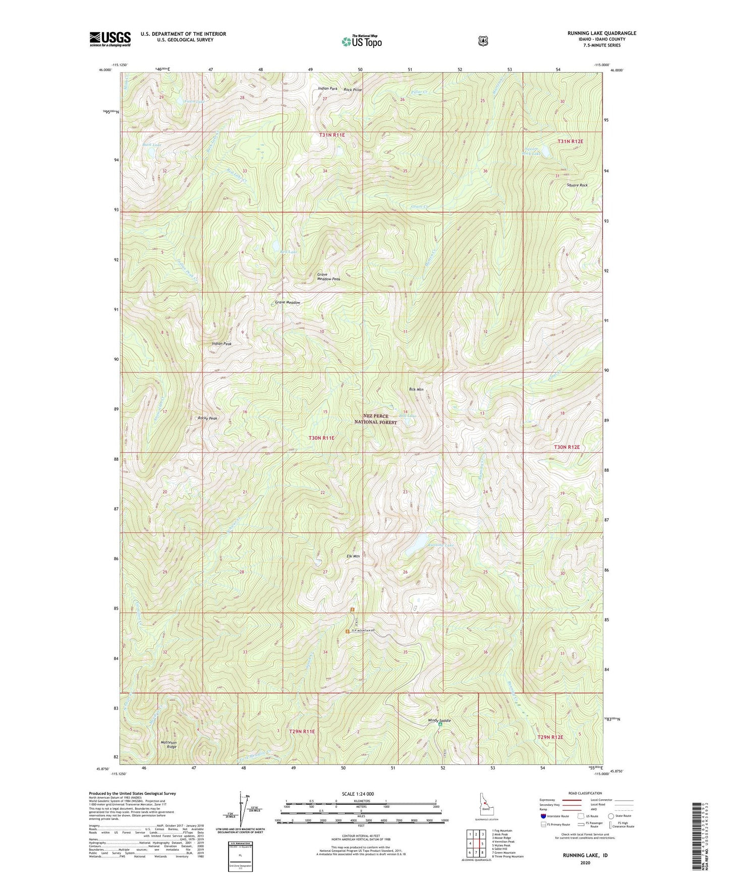
Running Lake Idaho US Topo Map
Couldn't load pickup availability
Also explore the Running Lake Forest Service Topo of this same quad for updated USFS data
2024 topographic map quadrangle Running Lake in the state of Idaho. Scale: 1:24000. Based on the newly updated USGS 7.5' US Topo map series, this map is in the following counties: Idaho. The map contains contour data, water features, and other items you are used to seeing on USGS maps, but also has updated roads and other features. This is the next generation of topographic maps. Printed on high-quality waterproof paper with UV fade-resistant inks.
Quads adjacent to this one:
West: Vermilion Peak
Northwest: Fog Mountain
North: Mink Peak
Northeast: Moose Ridge
East: Wylies Peak
Southeast: Three Prong Mountain
South: Green Mountain
Southwest: Sable Hill
This map covers the same area as the classic USGS quad with code o45115h1.
Contains the following named places: Bilk Lake, Bilk Mountain, Buck Lake, East Fork Meadow Creek, Elk Mountain, Fawn Lake, First Smoke Jump Site, Goat Lake, Grave Creek, Grave Meadow, Grave Meadow Peak, Indian Park, Indian Peak, Indian Peak Creek, Red Lake, Red Lake Creek, Rock Pillar, Rocky Peak, Running Lake, Schwar Creek, Spook Creek, Square Rock, Square Rock Lake, Vermilion Creek, Windy Saddle