MyTopo
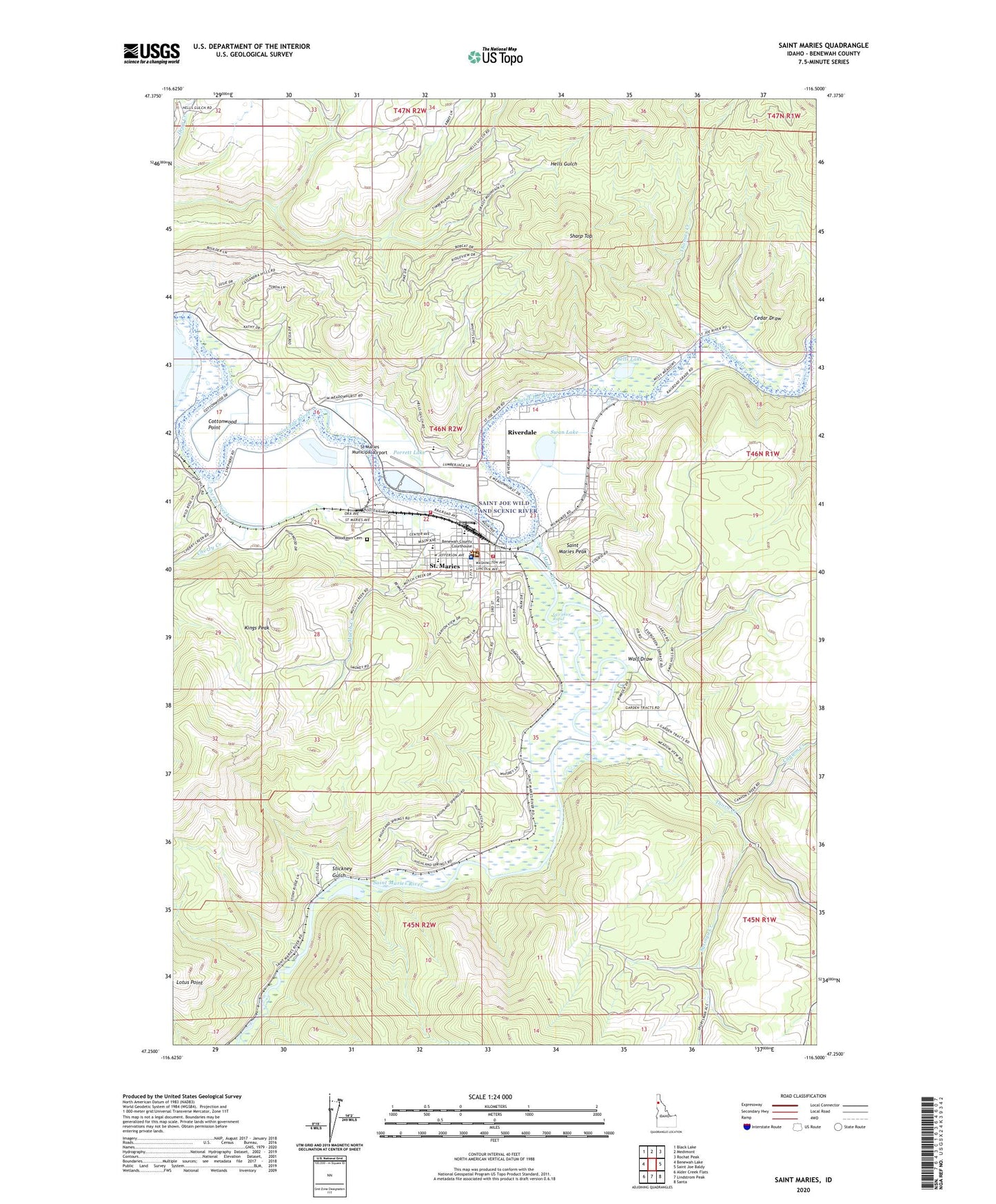
Saint Maries Idaho US Topo Map
Couldn't load pickup availability
Also explore the Saint Maries Forest Service Topo of this same quad for updated USFS data
2024 topographic map quadrangle Saint Maries in the state of Idaho. Scale: 1:24000. Based on the newly updated USGS 7.5' US Topo map series, this map is in the following counties: Benewah. The map contains contour data, water features, and other items you are used to seeing on USGS maps, but also has updated roads and other features. This is the next generation of topographic maps. Printed on high-quality waterproof paper with UV fade-resistant inks.
Quads adjacent to this one:
West: Benewah Lake
Northwest: Black Lake
North: Medimont
Northeast: Rochat Peak
East: Saint Joe Baldy
Southeast: Santa
South: Lindstrom Peak
Southwest: Alder Creek Flats
This map covers the same area as the classic USGS quad with code o47116c5.
Contains the following named places: Bells Lake, Benewah Community Hospital, Benewah Community Hospital Heliport, Benewah County Sheriff's Office, Canyon Creek, Cedar Draw, Chat'u'washa'lqs Bluff, Cherry Creek, City of Saint Maries, Cottonwood Point, Heyburn Elementary School, Hnmlmulsh Grove, Kings Peak, KOFE-AM (Saint Maries), Lq'e'ykwe' Rapid, Meadowhurst, Milltown, Mullen Trail Park Historical Monument, Mutch Creek, Porrett Lake, Potlatch Corporation Fire Department, Riverdale, Saint Maries, Saint Maries Ambulance, Saint Maries Christian School, Saint Maries Country Club, Saint Maries Fire Protection District Station 1, Saint Maries High School, Saint Maries Middle School, Saint Maries Peak, Saint Maries Police Department, Saint Maries Post Office, Saint Maries Ranger Station, Saint Maries River, Saint Maries River Access, Saint Maries River Access Area, Saint Maries Wildlife Management Area, Sharp Top, St Maries Municipal Airport, Stickney Gulch, Swan Lake, Syringa Creek, Thomas Creek, Thorn Creek, Wolf Draw, Woodlawn Cemetery, ZIP Code: 83861