MyTopo
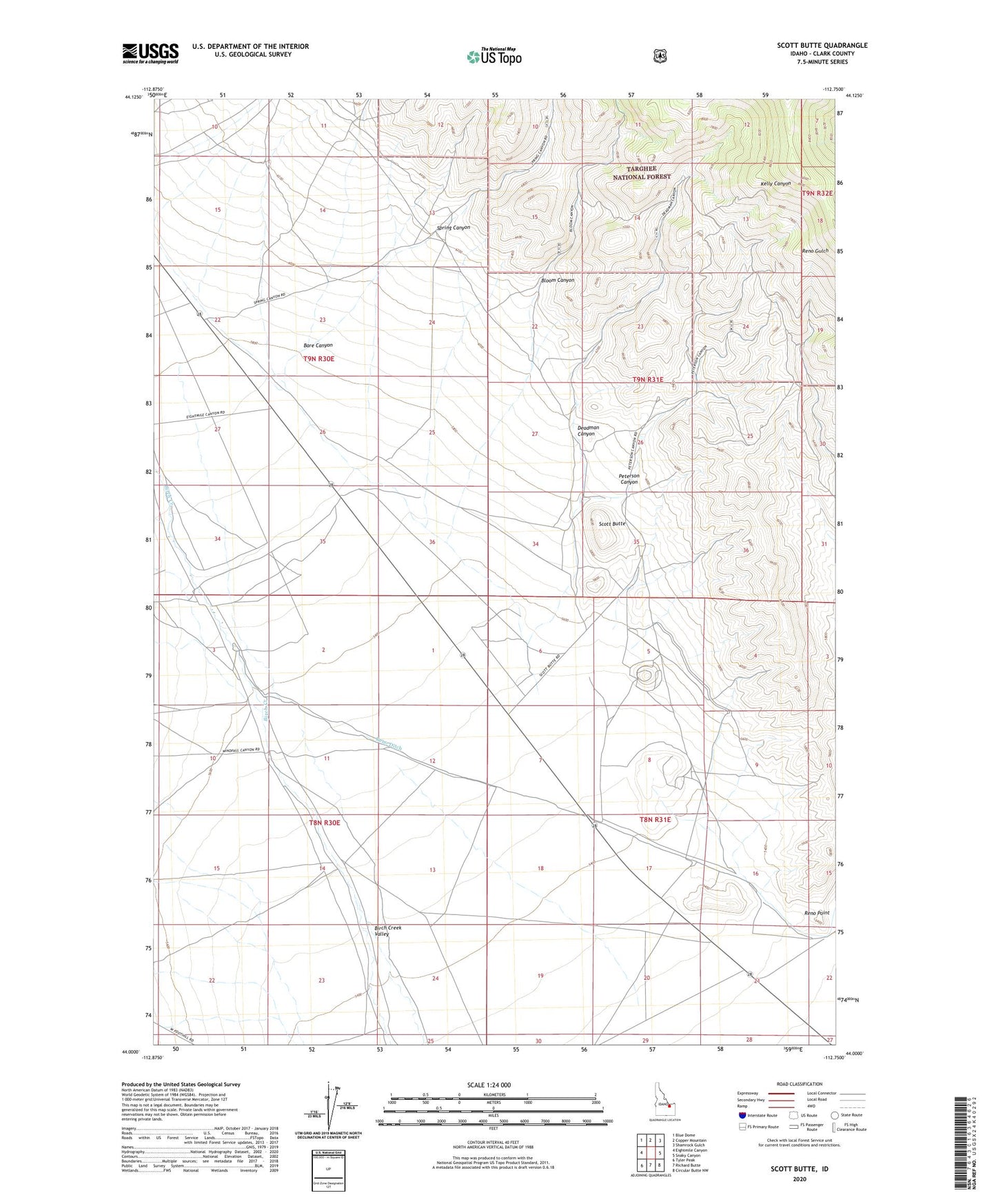
Scott Butte Idaho US Topo Map
Couldn't load pickup availability
Also explore the Scott Butte Forest Service Topo of this same quad for updated USFS data
2023 topographic map quadrangle Scott Butte in the state of Idaho. Scale: 1:24000. Based on the newly updated USGS 7.5' US Topo map series, this map is in the following counties: Clark. The map contains contour data, water features, and other items you are used to seeing on USGS maps, but also has updated roads and other features. This is the next generation of topographic maps. Printed on high-quality waterproof paper with UV fade-resistant inks.
Quads adjacent to this one:
West: Eightmile Canyon
Northwest: Blue Dome
North: Copper Mountain
Northeast: Shamrock Gulch
East: Snaky Canyon
Southeast: Circular Butte NW
South: Richard Butte
Southwest: Tyler Peak
This map covers the same area as the classic USGS quad with code o44112a7.
Contains the following named places: Bare Canyon, Birch Creek Valley, Bloom Canyon, Deadman Canyon, Peterson Canyon, Reno Ditch, Reno Point, Scott Butte, Spring Canyon