MyTopo
Warm River Idaho US Topo Map
Couldn't load pickup availability
Also explore the Warm River Forest Service Topo of this same quad for updated USFS data
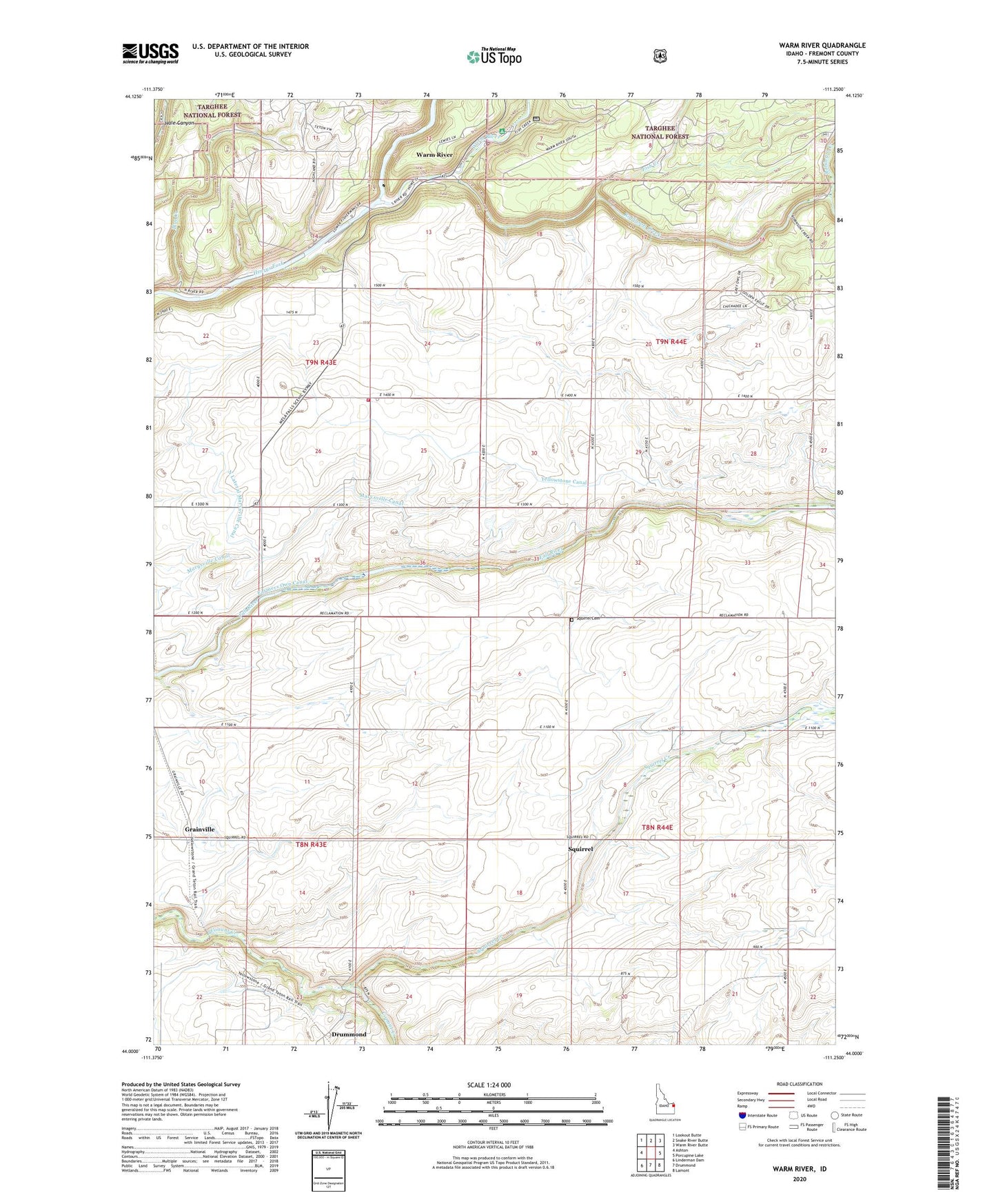
2023 topographic map quadrangle Warm River in the state of Idaho. Scale: 1:24000. Based on the newly updated USGS 7.5' US Topo map series, this map is in the following counties: Fremont. The map contains contour data, water features, and other items you are used to seeing on USGS maps, but also has updated roads and other features. This is the next generation of topographic maps. Printed on high-quality waterproof paper with UV fade-resistant inks.
Quads adjacent to this one:
West: Ashton
Northwest: Lookout Butte
North: Snake River Butte
Northeast: Warm River Butte
East: Porcupine Lake
Southeast: Lamont
South: Drummond
Southwest: Linderman Dam
This map covers the same area as the classic USGS quad with code o44111a3.
Contains the following named places: Ashton Division, Aspen Acres Golf Club, Blue Creek, City of Warm River, Fish Creek, Grainville, Greentimber, Marysville Canal, Pops Dam, Robinson Creek, Rock Creek, Squirrel, Squirrel Cemetery, Squirrel Creek, Stephens Fish Creek Ranch, Warm River, Warm River Campground, Yellowstone Canal, ZIP Code: 83420