MyTopo
Snake River Butte Idaho US Topo Map
Couldn't load pickup availability
Also explore the Snake River Butte Forest Service Topo of this same quad for updated USFS data
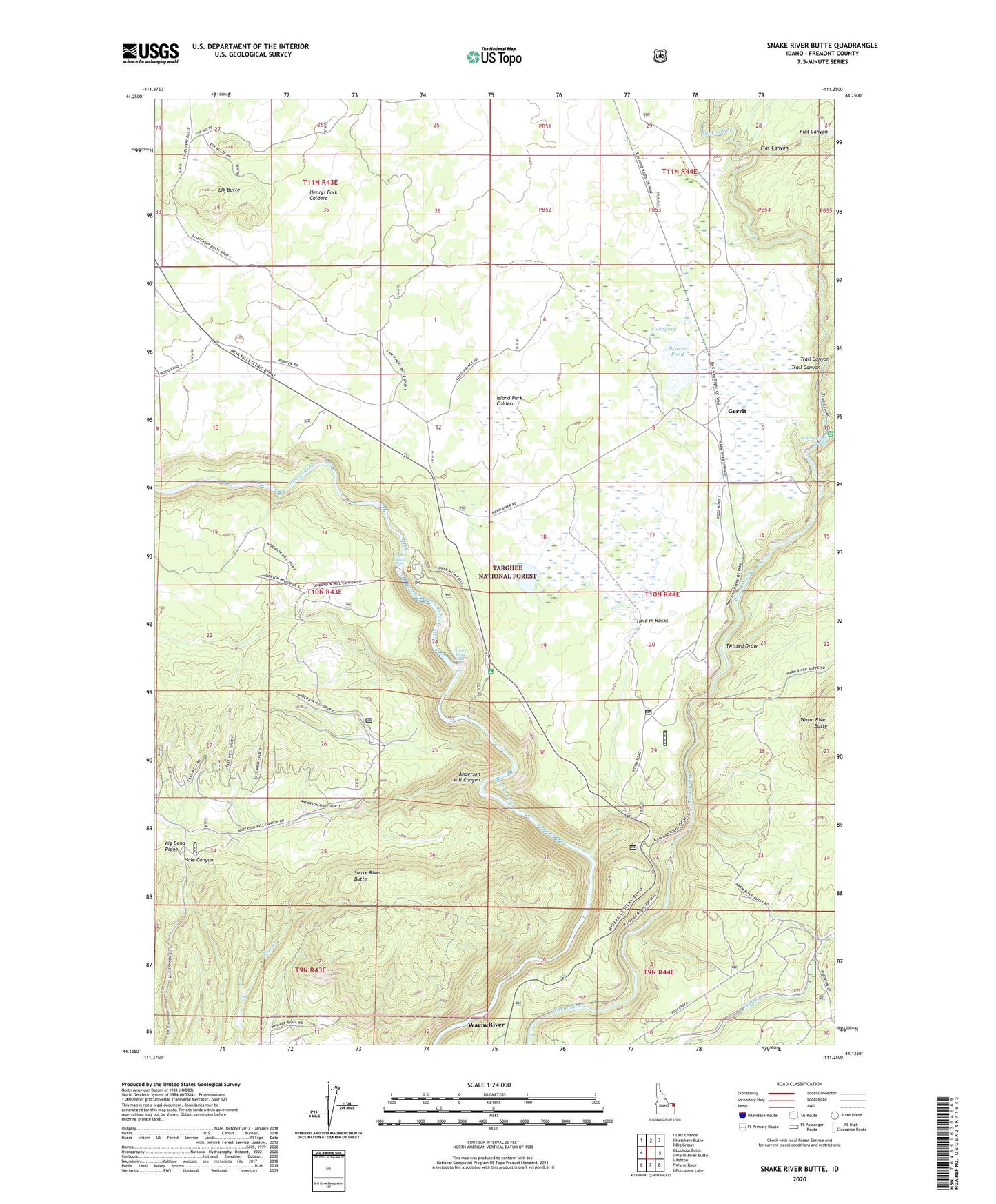
2024 topographic map quadrangle Snake River Butte in the state of Idaho. Scale: 1:24000. Based on the newly updated USGS 7.5' US Topo map series, this map is in the following counties: Fremont. The map contains contour data, water features, and other items you are used to seeing on USGS maps, but also has updated roads and other features. This is the next generation of topographic maps. Printed on high-quality waterproof paper with UV fade-resistant inks.
Quads adjacent to this one:
West: Lookout Butte
Northwest: Last Chance
North: Hatchery Butte
Northeast: Big Grassy
East: Warm River Butte
Southeast: Porcupine Lake
South: Warm River
Southwest: Ashton
This map covers the same area as the classic USGS quad with code o44111b3.
Contains the following named places: Anderson Mill Canyon, Bear Gulch Campground, Bear Gulch Gravel Pit, Bear Gulch Ski Area, Beaver Pond, Cherry Dam, Cold Spring, Elk Butte, Gerrit, Grandview Overlook, Hole in Rocks, Lower Mesa Falls, Moose Creek, Snake River Butte, Trail Canyon, Twisted Draw, Upper Mesa Falls, Warm River Fish Hatchery, Warm River Spring