MyTopo
Wickahoney Crossing Idaho US Topo Map
Couldn't load pickup availability
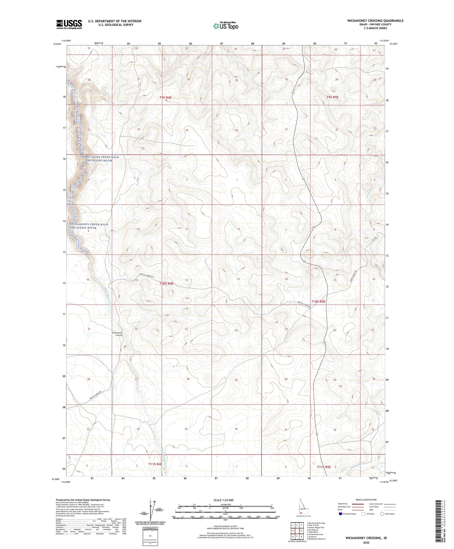
2023 topographic map quadrangle Wickahoney Crossing in the state of Idaho. Scale: 1:24000. Based on the newly updated USGS 7.5' US Topo map series, this map is in the following counties: Owyhee. The map contains contour data, water features, and other items you are used to seeing on USGS maps, but also has updated roads and other features. This is the next generation of topographic maps. Printed on high-quality waterproof paper with UV fade-resistant inks.
Quads adjacent to this one:
West: Hill Pasture
Northwest: Big Horse Basin Gap
North: Hole In Rock
Northeast: Broken Wagon Flat
East: Table Butte
Southeast: Blackstone Reservoir
South: Grasmere
Southwest: Wickahoney Point
This map covers the same area as the classic USGS quad with code o42115e8.
Contains the following named places: Big Hill, Big Jacks Creek Wild and Scenic River, Parker Trail, Wickahoney Creek Wild and Scenic River, Wickahoney Crossing