MyTopo
Yandell Springs Idaho US Topo Map
Couldn't load pickup availability
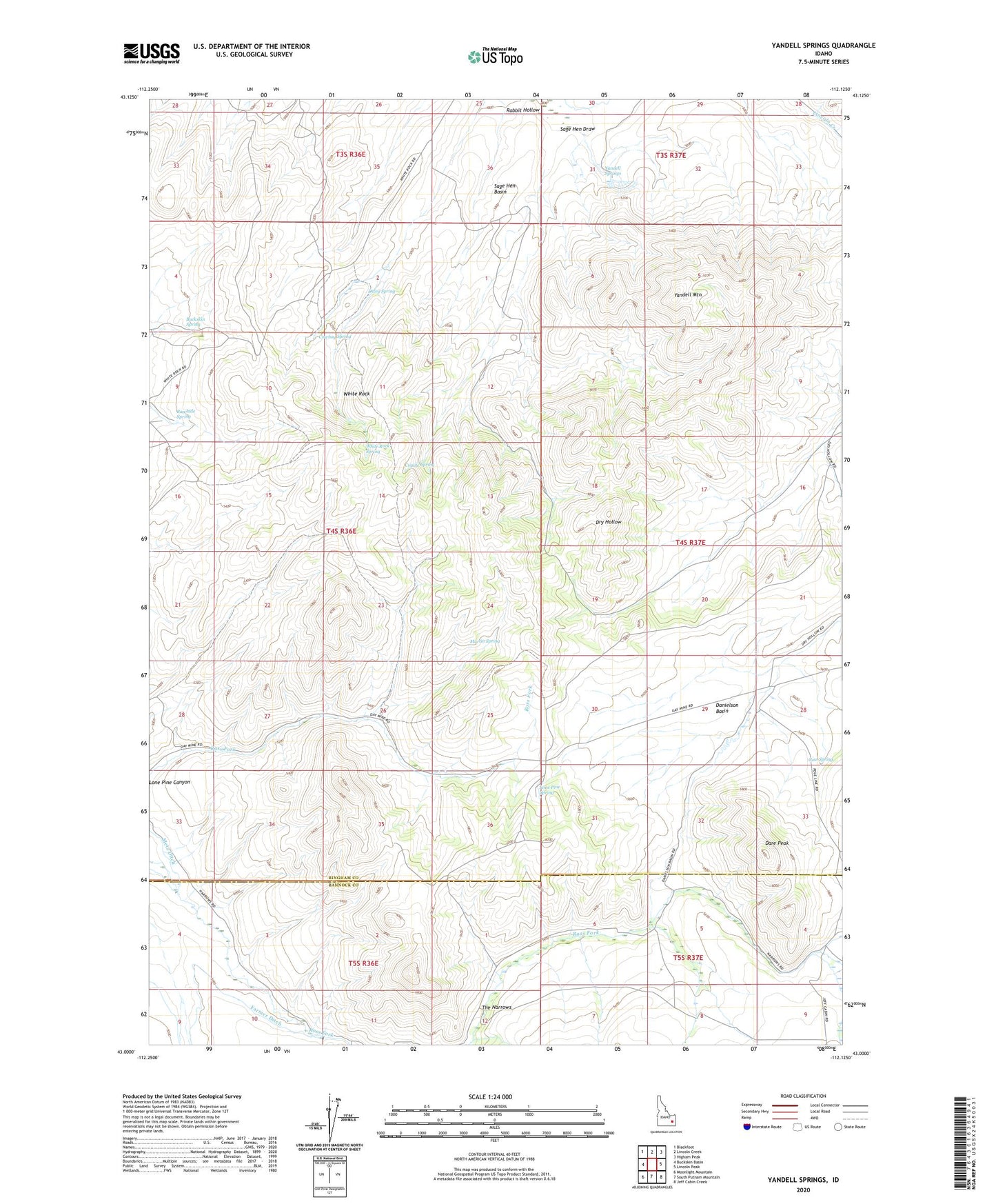
2023 topographic map quadrangle Yandell Springs in the state of Idaho. Scale: 1:24000. Based on the newly updated USGS 7.5' US Topo map series, this map is in the following counties: Bingham, Bannock. The map contains contour data, water features, and other items you are used to seeing on USGS maps, but also has updated roads and other features. This is the next generation of topographic maps. Printed on high-quality waterproof paper with UV fade-resistant inks.
Quads adjacent to this one:
West: Buckskin Basin
Northwest: Blackfoot
North: Lincoln Creek
Northeast: Higham Peak
East: Lincoln Peak
Southeast: Jeff Cabin Creek
South: South Putnam Mountain
Southwest: Moonlight Mountain
This map covers the same area as the classic USGS quad with code o43112a2.
Contains the following named places: Buckskin Spring, Cow Spring, Cowboy Spring, Coyote Spring, Danielson Basin, Dare Peak, Dixey Spring, Dry Hollow Well, Fort Hall Division, Lone Pine Spring, Martin Spring, Rabbit Hollow, Rawhide Spring, Sage Hen Basin, Sage Hen Draw, Westvaco, White Rock, White Rock Spring, Yandell Mountain, Yandell Springs